Latitude: 51.3486 / 51°20'54"N
Longitude: 0.7322 / 0°43'55"E
OS Eastings: 590364
OS Northings: 164601
OS Grid: TQ903646
Mapcode National: GBR QRV.KXJ
Mapcode Global: VHKJL.MCYJ
Plus Code: 9F328PXJ+CV
Entry Name: No 65, Including the Building (Former Stables) Adjoining on the South West
Listing Date: 10 September 1951
Grade: II
Source: Historic England
Source ID: 1345556
English Heritage Legacy ID: 175732
ID on this website: 101345556
Location: Milton Regis, Swale, Kent, ME10
County: Kent
District: Swale
Electoral Ward/Division: Milton Regis
Parish: Non Civil Parish
Built-Up Area: Sittingbourne
Traditional County: Kent
Lieutenancy Area (Ceremonial County): Kent
Tagged with: Building
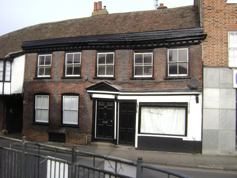
1. 5282 HIGH STREET (West Side) MILTON REGIS No 65, including the building (former stables) adjoining on the south-west TQ 9614 NW 1/94 10.9.51, II GV 2. Formerly the Crown Inn. C18 front to a probable timber-framed building. 2 storeys grey headers with red brick window dressings, quoins, stringcourse and vertical strips. Tiled roof with parapet and wooden modillion eaves cornice. 5 sashes with glazing bars missing. Doorcase in moulded architrave surround with pediment over supported on brackets and door of 6 fielded panels, the top 2 panels cut away and glazed. Modern shop front to the right of this. Adjoining on the south-west is a building that was formerly the stables of the inn. This is a fine 2 storey timber-framed building with red brick infilling on the 1st floor which oversails on the protruding ends of the floor joists. The ground floor is red brick with 6 pilasters. 3 original but unglazed windows on the 1st floor with wooden mullions and one C18 bay, with glazing bars intact, at the north-east end. Carriage archway beneath this with curved braces and double doors. Small modern shop window at the other end of the building.
No 65 including the building adjoining on the south-west Nos 67 to 71 (odd). 71A, 73, 73A, 75 to 87 (odd), 87A, 89 to 95 (odd), 95A, 97, 97A, 99 and 99A form a group.
Listing NGR: TQ9036464601
External links are from the relevant listing authority and, where applicable, Wikidata. Wikidata IDs may be related buildings as well as this specific building. If you want to add or update a link, you will need to do so by editing the Wikidata entry.


Other nearby listed buildings