Approximate Location Map
Large Map »
Latitude: 51.3486 / 51°20'54"N
Longitude: 0.7327 / 0°43'57"E
OS Eastings: 590398
OS Northings: 164598
OS Grid: TQ903645
Mapcode National: GBR RT6.D26
Mapcode Global: VHKJL.NC6J
Plus Code: 9F328PXM+C3
Entry Name: 62, High Street
Listing Date: 13 December 1974
Grade: II
Source: Historic England
Source ID: 1374224
English Heritage Legacy ID: 175753
ID on this website: 101374224
Location: Milton Regis, Swale, Kent, ME10
County: Kent
District: Swale
Electoral Ward/Division: Milton Regis
Parish: Non Civil Parish
Built-Up Area: Sittingbourne
Traditional County: Kent
Lieutenancy Area (Ceremonial County): Kent
Tagged with: Building
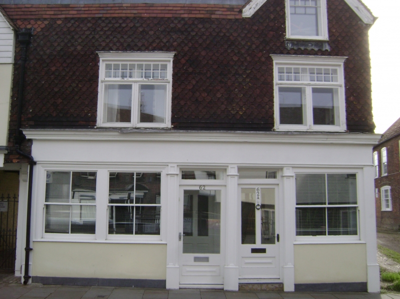
1.
5282 HIGH STREET
(East Side)
MILTON REGIS
No 62
TQ 9064 NW 1/132
II GV
2.
Mid C19 facade to possible timber-framed building. 2 storeys and attics faced
with curved tiles, Tiled roof set behind parapet. 2 paired casements. Later
shop front. Grade II for group value.
Nos 52 to 76 (even), 80 to 104 (even), 104A and 110 form a group.
Listing NGR: TQ9039864598
External links are from the relevant listing authority and, where applicable, Wikidata. Wikidata IDs may be related buildings as well as this specific building. If you want to add or update a link, you will need to do so by editing the Wikidata entry.


Other nearby listed buildings
