Approximate Location Map
Large Map »
Latitude: 53.8419 / 53°50'30"N
Longitude: -0.4313 / 0°25'52"W
OS Eastings: 503314
OS Northings: 439546
OS Grid: TA033395
Mapcode National: GBR TSF0.FJ
Mapcode Global: WHGF4.BPWL
Plus Code: 9C5XRHR9+QF
Entry Name: 12, Toll Gavel
Listing Date: 2 July 1969
Last Amended: 2 September 1969
Grade: II
Source: Historic England
Source ID: 1346400
English Heritage Legacy ID: 167485
ID on this website: 101346400
Location: Beverley, East Riding of Yorkshire, HU17
County: East Riding of Yorkshire
Civil Parish: Beverley
Built-Up Area: Beverley
Traditional County: Yorkshire
Lieutenancy Area (Ceremonial County): East Riding of Yorkshire
Church of England Parish: Beverley St Mary
Church of England Diocese: York
Tagged with: Building
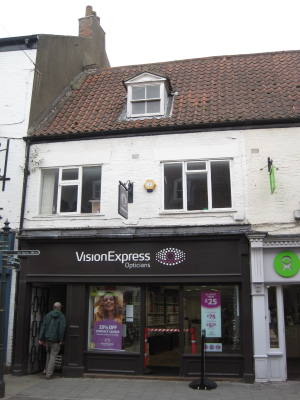
BEVERLEY TOLL GAVEL
TA 0339 (south side)
9/358
No 12
2.7.69
GV II
Early C18, with alterations. 2 storeys and attics in painted brick with
pantile roof. 2 windows with flush frames, now with metal casements.
Pedimented dormer with sash window. Modern shop front to ground floor.
Listing NGR: TA0331439546
External links are from the relevant listing authority and, where applicable, Wikidata. Wikidata IDs may be related buildings as well as this specific building. If you want to add or update a link, you will need to do so by editing the Wikidata entry.


Other nearby listed buildings
