Latitude: 53.9913 / 53°59'28"N
Longitude: -0.9118 / 0°54'42"W
OS Eastings: 471443
OS Northings: 455574
OS Grid: SE714555
Mapcode National: GBR QQ28.DZ
Mapcode Global: WHFBZ.YYZ3
Plus Code: 9C5XX3RQ+G7
Entry Name: 18, Main Street
Listing Date: 14 April 1987
Grade: II
Source: Historic England
Source ID: 1346428
English Heritage Legacy ID: 167748
ID on this website: 101346428
Location: Stamford Bridge, East Riding of Yorkshire, YO41
County: East Riding of Yorkshire
Civil Parish: Stamford Bridge
Built-Up Area: Stamford Bridge
Traditional County: Yorkshire
Lieutenancy Area (Ceremonial County): East Riding of Yorkshire
Church of England Parish: Stamford Bridge St John the Baptist
Church of England Diocese: York
Tagged with: Building
STAMFORD BRIDGE MAIN STREET 7155 (south side) 7/59 No 18 GV II
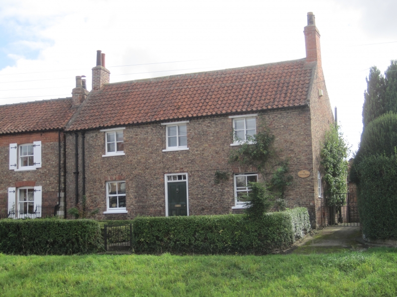
House. Late C18/early C19. Brown brick, pantiled roof. 2 storeys, 3 bays, symmetrical elevation. Centre 4-panel door with overlight with glazing bars flanked to right and to left by 4-pane sashes with sills under flat brick arches. First floor: 3 sliding sashes with glazing bars and sills under timber lintels. Dentilled brick eaves cornice, end stacks, tumbled-in brick to raised gables. Included for group value.
Listing NGR: SE7144355574
External links are from the relevant listing authority and, where applicable, Wikidata. Wikidata IDs may be related buildings as well as this specific building. If you want to add or update a link, you will need to do so by editing the Wikidata entry.


Other nearby listed buildings