Latitude: 53.6925 / 53°41'32"N
Longitude: -1.0313 / 1°1'52"W
OS Eastings: 464062
OS Northings: 422217
OS Grid: SE640222
Mapcode National: GBR PT7R.J2
Mapcode Global: WHFDH.4G54
Plus Code: 9C5WMXR9+XF
Entry Name: Snaith Old Grammar School
Listing Date: 23 April 1952
Last Amended: 16 December 1986
Grade: II
Source: Historic England
Source ID: 1347049
English Heritage Legacy ID: 164922
ID on this website: 101347049
Location: Priory Church of St Laurence, Snaith, East Riding of Yorkshire, DN14
County: East Riding of Yorkshire
Civil Parish: Snaith and Cowick
Built-Up Area: Snaith
Traditional County: Yorkshire
Lieutenancy Area (Ceremonial County): East Riding of Yorkshire
Church of England Parish: Great Snaith
Church of England Diocese: Sheffield
Tagged with: School building
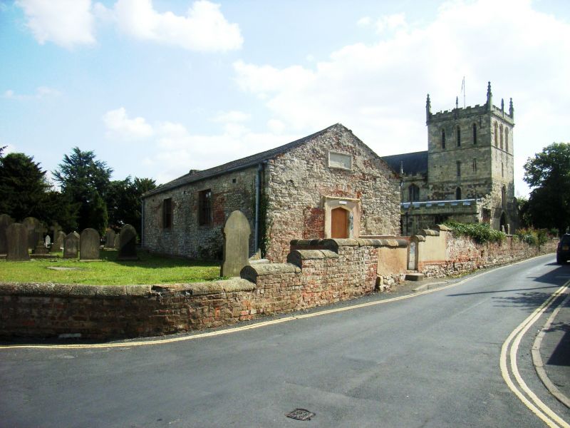
SNAITH AND COWICK HIGH STREET SE 6422 (north side, off) 12/61 Snaith Old Grammar School (formerly listed under 23.4.52 Church Lane) GV II School, now church room. C15-C16 origins with unsympathetic later alterations and west extension. Coursed limestone rubble and ashlar with brick infilling and patching, rendered to east gable-end; west extension in rendered brick. Concrete tile roof. Rectangular on plan: single room with entrance to east end and extension to west. South side: pair of C19-C20 16-pane sashes in rendered reveals, blocked central opening (perhaps former door) with ashlar jambs and lintel, with blocked opening or panel above with rough ashlar surround; windows cut blocked former openings with ashlar lintels; single jamb visible to right. North side: pair of similar sashes, that to left cutting a blocked opening beneath a segmental brick arch, that to right cutting a blocked square-headed opening. East gable-end: central C20 door beneath ashlar lintel flanked by blocked opening to left in chamfered ashlar surround, blocked opening to right with brick and ashlar infill. West gable bears worn sandstone tablet with largely illegible inscription: "This School, supposed to have been built in -28 was restored at the expense of - Yarburgh -". Listed mainly for historic interest.
Listing NGR: SE6406222215
External links are from the relevant listing authority and, where applicable, Wikidata. Wikidata IDs may be related buildings as well as this specific building. If you want to add or update a link, you will need to do so by editing the Wikidata entry.


Other nearby listed buildings