Latitude: 51.2185 / 51°13'6"N
Longitude: 1.2213 / 1°13'16"E
OS Eastings: 625050
OS Northings: 151521
OS Grid: TR250515
Mapcode National: GBR W0C.HLD
Mapcode Global: VHLGX.4M0R
Plus Code: 9F33669C+CG
Entry Name: Stables About 40 Metres South of Holt Street Farmhouse
Listing Date: 3 December 1986
Grade: II
Source: Historic England
Source ID: 1348506
English Heritage Legacy ID: 177998
ID on this website: 101348506
Location: Snowdown, Dover, Kent, CT15
County: Kent
District: Dover
Civil Parish: Nonington
Traditional County: Kent
Lieutenancy Area (Ceremonial County): Kent
Tagged with: Stable
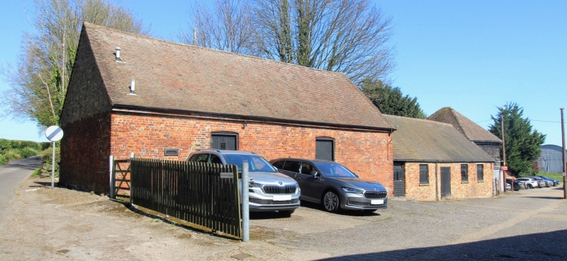
NONINGTON HOLT STREET TR 25 SE (north west side) 3/137 Stables about 40 metres south of Holt Street Farmhouse GV II Stables. Mid C19 rebuild of C17 block. Red brick with plain tiled roof. One storey. Boarded half doors with mullioned rectangular fanlights to left and to right with central horizontally sliding glazing bar sash. Rear elevation with 2 segmentally headed doorways, also with remains of flint plinth and early brickwork. Included for group value.
Listing NGR: TR2505851567
External links are from the relevant listing authority and, where applicable, Wikidata. Wikidata IDs may be related buildings as well as this specific building. If you want to add or update a link, you will need to do so by editing the Wikidata entry.


Other nearby listed buildings