Latitude: 52.1702 / 52°10'12"N
Longitude: -2.2425 / 2°14'32"W
OS Eastings: 383511
OS Northings: 252469
OS Grid: SO835524
Mapcode National: GBR 1G9.XJ7
Mapcode Global: VH92T.2QV5
Plus Code: 9C4V5QC5+32
Entry Name: Powick Old Bridge
Listing Date: 25 March 1968
Grade: I
Source: Historic England
Source ID: 1349275
English Heritage Legacy ID: 153407
ID on this website: 101349275
Location: Lower Wick, Worcester, Worcestershire, WR2
County: Worcestershire
District: Worcester
Electoral Ward/Division: Bedwardine
Parish: Non Civil Parish
Built-Up Area: Worcester
Traditional County: Worcestershire
Lieutenancy Area (Ceremonial County): Worcestershire
Church of England Parish: St John in Bedwardine
Church of England Diocese: Worcester
POWICK CP A 449 (off)
SO 85 SW
3/89 Powick Old Bridge
25.3.68
GV I
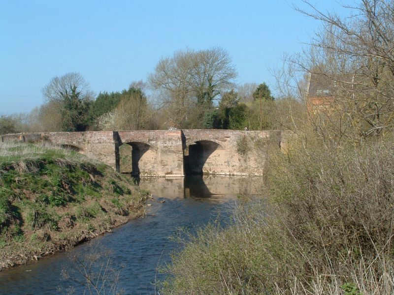
Bridge. Late medieval with C17 alterations. Stone with brick parapets.
Has three stone skew arches separated by triangular cutwaters with pedestrian
refuges; two further northern arches are C17 and are segmental; the southern
one is of brick. The first and second battles of Worcester, which opened and
closed the Civil War, took place at the bridge, in 1642 and 1651. The two
northern-piers of the bridge were destroyed by the Royalists in 1651. Part
of this bridge is in the City of Worcester (qv). (VCH, vol 4, p 184).
Scheduled Ancient Monument, County no 323.
Listing NGR: SO8351152469
External links are from the relevant listing authority and, where applicable, Wikidata. Wikidata IDs may be related buildings as well as this specific building. If you want to add or update a link, you will need to do so by editing the Wikidata entry.


Other nearby listed buildings