Approximate Location Map
Large Map »
Latitude: 51.3875 / 51°23'14"N
Longitude: 1.3802 / 1°22'48"E
OS Eastings: 635280
OS Northings: 170803
OS Grid: TR352708
Mapcode National: GBR WZS.V3L
Mapcode Global: VHLG6.WD16
Plus Code: 9F3399PJ+X3
Entry Name: 21, Marine Gardens
Listing Date: 22 February 1973
Grade: II
Source: Historic England
Source ID: 1351072
English Heritage Legacy ID: 356615
ID on this website: 101351072
Location: Margate, Thanet, Kent, CT9
County: Kent
District: Thanet
Electoral Ward/Division: Margate Central
Parish: Non Civil Parish
Built-Up Area: Margate
Traditional County: Kent
Lieutenancy Area (Ceremonial County): Kent
Tagged with: Building
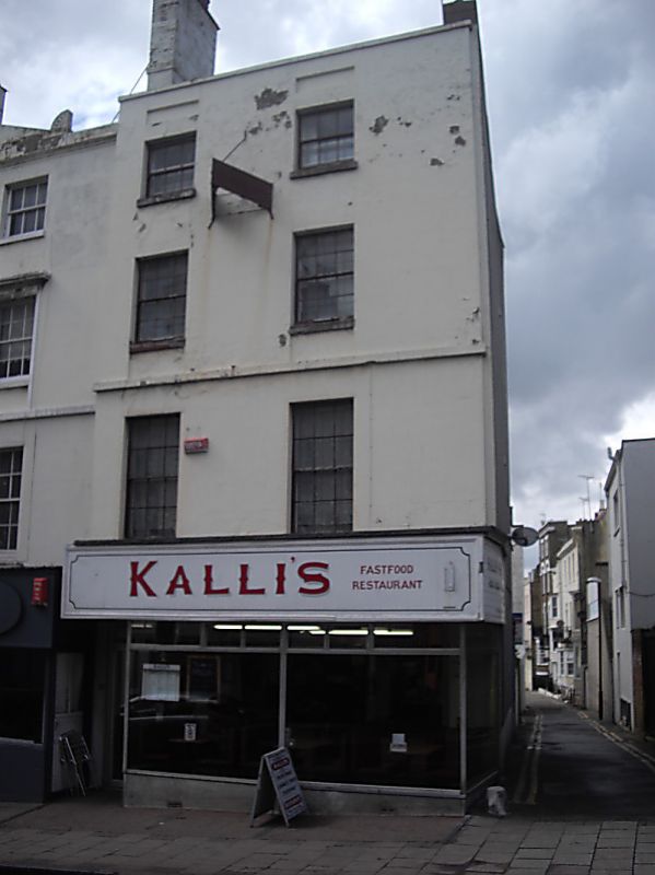
MARINE GARDENS
1.
1380
(North Side)
No 21
TR 3570 NW 1/229
II GV
2.
Early C19. 4 storeys and basement stuccoed. Parapet with stone coping.
2 sashes without glazing bars. Recessed blank panels above 3rd floor windows.
Stringcourse. Later shopfront.
Nos 20, 20A and 21 form a group with Nos 13 to 19A (consec) Albert Terrace
Listing NGR: TR3528070803
External links are from the relevant listing authority and, where applicable, Wikidata. Wikidata IDs may be related buildings as well as this specific building. If you want to add or update a link, you will need to do so by editing the Wikidata entry.


Other nearby listed buildings
