Latitude: 51.3875 / 51°23'14"N
Longitude: 1.3806 / 1°22'50"E
OS Eastings: 635305
OS Northings: 170805
OS Grid: TR353708
Mapcode National: GBR WZS.V65
Mapcode Global: VHLG6.WD66
Plus Code: 9F3399PJ+X6
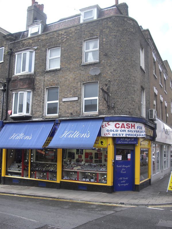
Entry Name: 82, High Street
Listing Date: 22 February 1973
Grade: II
Source: Historic England
Source ID: 1094639
English Heritage Legacy ID: 356590
ID on this website: 101094639
Location: Margate, Thanet, Kent, CT9
County: Kent
District: Thanet
Electoral Ward/Division: Margate Central
Parish: Non Civil Parish
Built-Up Area: Margate
Traditional County: Kent
Lieutenancy Area (Ceremonial County): Kent
Tagged with: Building
HIGH SWEET
1.
1380
(West Side)
No 82
TR 3570 NW 1/200
II GV
2.
Circa 1840. 3 storeys stock brick. Renewed tiled mansard roof with 2 dormers.
Stone coping. 3 sashes with cambered heads and 1 Norman Shaw type bay. Later
shopfront.
Nos 72 and Nos 76 to 82 (even) form a group
Listing NGR: TR3530570805
External links are from the relevant listing authority and, where applicable, Wikidata. Wikidata IDs may be related buildings as well as this specific building. If you want to add or update a link, you will need to do so by editing the Wikidata entry.


Other nearby listed buildings