Latitude: 52.3374 / 52°20'14"N
Longitude: -1.2822 / 1°16'55"W
OS Eastings: 449005
OS Northings: 271276
OS Grid: SP490712
Mapcode National: GBR 7PM.DN0
Mapcode Global: VHCTX.QJJ0
Plus Code: 9C4W8PP9+X4
Entry Name: Terrace Wall and Steps South and West of Dunchurch Lodge
Listing Date: 18 January 2001
Grade: II
Source: Historic England
Source ID: 1352672
English Heritage Legacy ID: 489711
ID on this website: 101352672
Location: Dunchurch, Rugby, Warwickshire, CV22
County: Warwickshire
District: Rugby
Civil Parish: Dunchurch
Traditional County: Warwickshire
Lieutenancy Area (Ceremonial County): Warwickshire
Church of England Parish: Dunchurch St Peter
Church of England Diocese: Coventry
Tagged with: Wall
DUNCHURCH
SP47SE RUGBY ROAD
1724/2/10036 Terrace Wall and Steps south and west
18-JAN-01 of Dunchurch Lodge
GV II
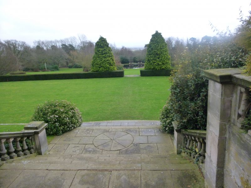
Terrace, walls and steps. 1908, by TH Mawson for John Lancaster. Ashlar and red brick. The terrace extends the full width of the south front of the house, and is defined on east, west and south sides by a retaining wall topped with a turned balustrade and square piers. In the centre of the south side is a flight of steps with an intermediate landing, the lower flight with curving splayed balustrade walls and ball finials. East and west ends, and the western wing terrace, have single flights of plain steps.
Attached to the east end of the house, and in line with the south front, a similar retaining wall approx. 30m long, with an off-centre flight of steps, and wider steps at the splayed SE angle. The wall then runs NW approx. 10m and has a flight of semicircular steps. This wall formerly enclosed the entrance court, and its balustrade and gateways were removed during alterations in 1951-52. One pair of gates was removed to Caldecott Park, Rugby.
West of the house, and in line with the south front, a brick wall approx.20m long and 3m high with moulded stone coping and a round arched doorway with lattice door and pedimented gable. NW of this, a low retaining wall approx. 30m long, with slab coping and 2 semicircular flights of steps to the former rose garden and bowling alley. At its NW end, this wall adjoins the kitchen garden wall, qv.
External links are from the relevant listing authority and, where applicable, Wikidata. Wikidata IDs may be related buildings as well as this specific building. If you want to add or update a link, you will need to do so by editing the Wikidata entry.


Other nearby listed buildings