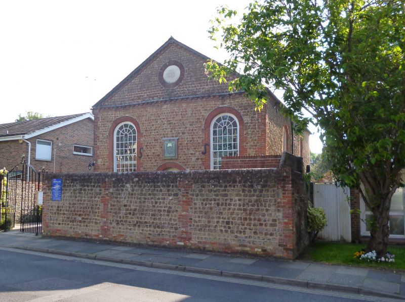
Latitude: 50.8392 / 50°50'21"N
Longitude: -0.7805 / 0°46'49"W
OS Eastings: 485966
OS Northings: 105117
OS Grid: SU859051
Mapcode National: GBR DGS.7HZ
Mapcode Global: FRA 967W.CRR
Plus Code: 9C2XR6Q9+MR
Entry Name: Walls and Gate Piers Enclosing Providence Chapel
Listing Date: 8 October 1971
Grade: II
Source: Historic England
Source ID: 1354292
English Heritage Legacy ID: 299837
ID on this website: 101354292
Location: Chichester, West Sussex, PO19
County: West Sussex
District: Chichester
Civil Parish: Chichester
Built-Up Area: Chichester
Traditional County: Sussex
Lieutenancy Area (Ceremonial County): West Sussex
Church of England Parish: Chichester St Paul
Church of England Diocese: Chichester
Tagged with: Wall
1. 972 CHAPEL STREET (West Side) ------------- Walls and gate piers enclosing Providence Chapel SU 8505 SE 1/248B
II
2. C.19: different dates. Wall of sandstone rubble and brick quoins and vertical courses of brick, about 7 feet high, enclosing Providence Chapel on east side. Brick coping. Gate piers at south end flanking entrance doors; gate piers of grey headers with red brick quoins; wooden doors. On south side, wall lower in height by some inches: flint with 2 brick lacing courses below; brick with modern brick capping above. On northern side, a higher wall: lower part of flint; brick above.
Listing NGR: SU8596605117
External links are from the relevant listing authority and, where applicable, Wikidata. Wikidata IDs may be related buildings as well as this specific building. If you want to add or update a link, you will need to do so by editing the Wikidata entry.


Other nearby listed buildings