Approximate Location Map
Large Map »
Latitude: 50.7808 / 50°46'50"N
Longitude: -0.8962 / 0°53'46"W
OS Eastings: 477913
OS Northings: 98494
OS Grid: SZ779984
Mapcode National: GBR CFW.VM4
Mapcode Global: FRA 9700.W4L
Plus Code: 9C2XQ4J3+8G
Entry Name: Pounces Cottage Rambler Cottage
Listing Date: 28 January 1986
Grade: II
Source: Historic England
Source ID: 1354667
English Heritage Legacy ID: 301519
ID on this website: 101354667
Location: West Wittering, Chichester, West Sussex, PO20
County: West Sussex
District: Chichester
Civil Parish: West Wittering
Built-Up Area: West Wittering
Traditional County: Sussex
Lieutenancy Area (Ceremonial County): West Sussex
Church of England Parish: West Wittering St Peter and St Paul
Church of England Diocese: Chichester
Tagged with: Cottage
WEST WITTERING POUND ROAD
SZ 79 NE
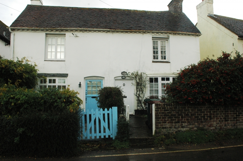
19/704 Pounces Cottage and Rambler
Cottage
-
- II
One building. Early C19. Two storeys. Two windows. Stuccoed. Modillion
eaves cornice. Tiled roof. Miscellaneous windows.
Listing NGR: SZ7791598494
External links are from the relevant listing authority and, where applicable, Wikidata. Wikidata IDs may be related buildings as well as this specific building. If you want to add or update a link, you will need to do so by editing the Wikidata entry.


Other nearby listed buildings
