Latitude: 50.9582 / 50°57'29"N
Longitude: -0.8832 / 0°52'59"W
OS Eastings: 478530
OS Northings: 118233
OS Grid: SU785182
Mapcode National: GBR CCR.ZFB
Mapcode Global: FRA 961K.V15
Plus Code: 9C2XX458+7P
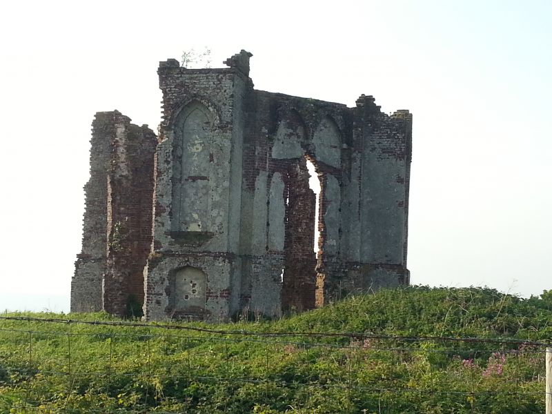
Entry Name: Ruins of the Vandalian Tower, Up Park
Listing Date: 18 June 1959
Grade: II
Source: Historic England
Source ID: 1354700
English Heritage Legacy ID: 301800
ID on this website: 101354700
Location: Chichester, West Sussex, GU31
County: West Sussex
District: Chichester
Civil Parish: Harting
Traditional County: Sussex
Lieutenancy Area (Ceremonial County): West Sussex
Church of England Parish: Harting St Mary and St Gabriel
Church of England Diocese: Chichester
SU 71 NE HARTING CHICHESTER ROAD 15/2 Ruins of the Vandalian 18.6.59 Tower, Up Park II Ornamental tower. Designed by Henry Keene for Sir Matthew Fetherstonhaugh about 1770. Originally a Tower built on top of the hill to the north of the house as a landmark, but now only portions of the ground floor remain. The plan is triangular with bastions at the angles. Red brick. Pointed windows. The Hellfire Club is said to have met here.
Listing NGR: SU7853018233


Other nearby listed buildings