Latitude: 52.6303 / 52°37'49"N
Longitude: 1.2939 / 1°17'38"E
OS Eastings: 623012
OS Northings: 308711
OS Grid: TG230087
Mapcode National: GBR W92.66
Mapcode Global: WHMTM.V4BW
Plus Code: 9F43J7JV+4H
Entry Name: 39, Exchange Street
Listing Date: 5 June 1972
Grade: II
Source: Historic England
Source ID: 1355123
English Heritage Legacy ID: 229083
ID on this website: 101355123
Location: Norwich, Norfolk, NR2
County: Norfolk
District: Norwich
Electoral Ward/Division: Mancroft
Parish: Non Civil Parish
Built-Up Area: Norwich
Traditional County: Norfolk
Lieutenancy Area (Ceremonial County): Norfolk
Church of England Parish: Norwich St Peter, Mancroft with St John Maddermarket
Church of England Diocese: Norwich
Tagged with: Building
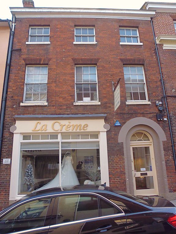
TG 2308 NW EXCHANGE STREET (east side) 16/329 5.6.72 No. 39 GV II Office. Early C19. Red brick. Roof not visible. 3 storeys. 3 bays. Door to right-hand side with semi-circular fanlight having radial glazing bars and double-order arch. C20 shopfront with reeded pilasters and fascia. Sash windows throughout with glazing bars and rubbed brick flat arches.
Listing NGR: TG2301208711
External links are from the relevant listing authority and, where applicable, Wikidata. Wikidata IDs may be related buildings as well as this specific building. If you want to add or update a link, you will need to do so by editing the Wikidata entry.


Other nearby listed buildings