Latitude: 52.064 / 52°3'50"N
Longitude: -1.6254 / 1°37'31"W
OS Eastings: 425774
OS Northings: 240694
OS Grid: SP257406
Mapcode National: GBR 5PS.HW9
Mapcode Global: VHBYM.SD12
Plus Code: 9C4W397F+JR
Entry Name: 36 and 38, Telegraph Street
Listing Date: 2 September 1952
Last Amended: 16 May 1988
Grade: II
Source: Historic England
Source ID: 1355623
English Heritage Legacy ID: 306516
ID on this website: 101355623
Location: Shipston-on-Stour, Stratford-on-Avon, Warwickshire, CV36
County: Warwickshire
District: Stratford-on-Avon
Civil Parish: Shipston on Stour
Built-Up Area: Shipston-on-Stour
Traditional County: Warwickshire
Lieutenancy Area (Ceremonial County): Warwickshire
Church of England Parish: Shipston-on-Stour St Edmund
Church of England Diocese: Coventry
Tagged with: Building
SHIPSTON ON STOUR TELEGRAPH STREET SP2540 (North Bide) 14/150 Nos.36 and 38 02/09/52 (Formerly listed as No.36, No.38 (separately listed))
- II
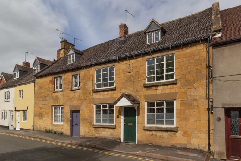
2 cottages, formerly house. Dated 1729. Limestone ashlar with coped gables. Plain tile roof with brick ridge stack and end stack with ashlar base. 2 storeys plus attic; 3-window range. 3-unit plan. To centre left a C19 four-panelled door with concrete lintel. To centre right a C20 four-panelled door with gabled hood. To left of ground floor a C19 three-light casement in original chamfered opening. To first floor left and centre left a C19 two-light casement. 2 ground floor and 2 first floor openings to No. 36, to right, are C20 three-light casements. Two gabled dormers. To first floor centre right a moulded datestone inscribed in bas-relief 'P/IA/1729'. Interior not inspected.
Listing NGR: SP2577440694
External links are from the relevant listing authority and, where applicable, Wikidata. Wikidata IDs may be related buildings as well as this specific building. If you want to add or update a link, you will need to do so by editing the Wikidata entry.


Other nearby listed buildings