Latitude: 50.9922 / 50°59'32"N
Longitude: -1.7451 / 1°44'42"W
OS Eastings: 417982
OS Northings: 121457
OS Grid: SU179214
Mapcode National: GBR 528.PMD
Mapcode Global: FRA 767H.7Y6
Plus Code: 9C2WX7R3+VW
Entry Name: Waterside Mill
Listing Date: 16 September 1974
Last Amended: 4 July 1985
Grade: II
Source: Historic England
Source ID: 1355717
English Heritage Legacy ID: 319598
ID on this website: 101355717
Location: Downton, Wiltshire, SP5
County: Wiltshire
Civil Parish: Downton
Built-Up Area: Downton
Traditional County: Wiltshire
Lieutenancy Area (Ceremonial County): Wiltshire
Church of England Parish: Downton St Lawrence
Church of England Diocese: Salisbury
Tagged with: Mill
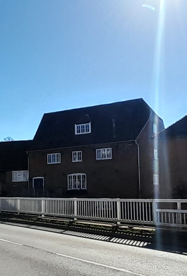
DOWNTON THE BOROUGH SU 1721 (south side) 5/39 Waterside Mill (formerly listed as Former Downton Power Station (excluding machinery) 13/9/74
GV II
Corn mill, later power station and now semi-detached house. C18, converted to power station by Southern Tannery Co. in 1929, closed 1973. English and Flemish bond brick, tiled roof with half-hip to right. 3-storey, 3-window. Ground floor has two 3-light segmental-headed casements, C20 door to first floor entrance up steps, to right is 4-light segmental-headed casement, second floor has two 3-light and one 2-light casement. Dentilled eaves cornice. Hipped dormer with 3-light casement to roof. Right return has blocked door and planked door to ground floor, 3-light casement to first floor, 2-light to second floor and attic. Rear has C20 door and 4-light casements to first floor, and four 2-light and one 3- light casement to second floor. Interior not inspected.
Listing NGR: SU1798421453
External links are from the relevant listing authority and, where applicable, Wikidata. Wikidata IDs may be related buildings as well as this specific building. If you want to add or update a link, you will need to do so by editing the Wikidata entry.


Other nearby listed buildings