Approximate Location Map
Large Map »
Latitude: 51.0629 / 51°3'46"N
Longitude: -1.7994 / 1°47'57"W
OS Eastings: 414153
OS Northings: 129299
OS Grid: SU141292
Mapcode National: GBR 51F.7WZ
Mapcode Global: FRA 7639.QT6
Plus Code: 9C3W3672+46
Entry Name: Boundary wall of 70 The Close running to south along road
Listing Date: 12 October 1972
Grade: II
Source: Historic England
Source ID: 1355817
English Heritage Legacy ID: 319065
ID on this website: 101355817
Location: The Close, Wiltshire, SP1
County: Wiltshire
Civil Parish: Salisbury
Built-Up Area: Salisbury
Traditional County: Wiltshire
Lieutenancy Area (Ceremonial County): Wiltshire
Tagged with: Wall
This list entry was subject to a Minor Amendment on 22 June 2021 to reformat the text to current standards
SU 1429 SW
5/5D
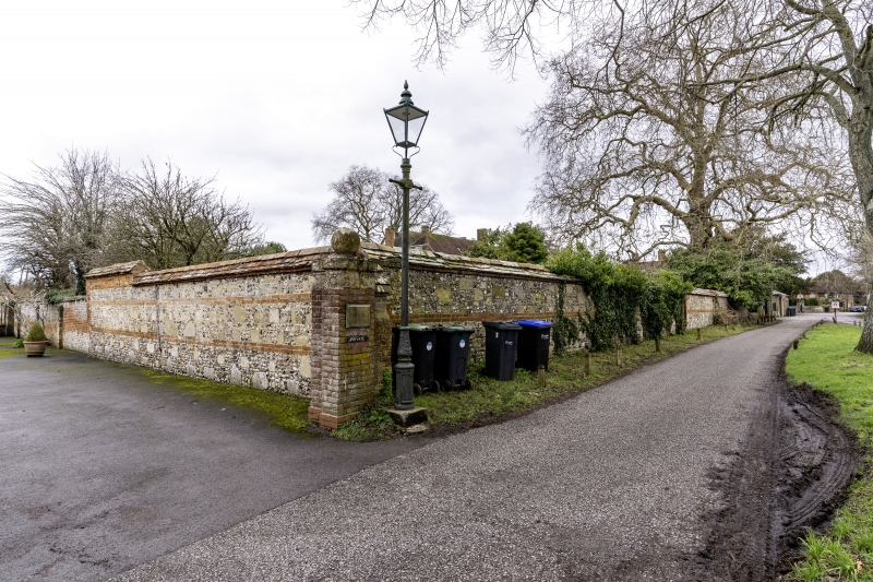
THE CLOSE
Boundary wall of No 70 running to south along road
GV
II
Approximately 6 ft high flint rubble and stone wall with tiled coping, brick bands at south end where there is a lantern on scrolled bracket.
All the listed buildings in the Close form an outstanding group.
Listing NGR: SU1415329300
External links are from the relevant listing authority and, where applicable, Wikidata. Wikidata IDs may be related buildings as well as this specific building. If you want to add or update a link, you will need to do so by editing the Wikidata entry.


Other nearby listed buildings
