Latitude: 51.5522 / 51°33'7"N
Longitude: -1.7715 / 1°46'17"W
OS Eastings: 415936
OS Northings: 183723
OS Grid: SU159837
Mapcode National: GBR YSQ.F9
Mapcode Global: VHB3M.77TY
Plus Code: 9C3WH62H+V9
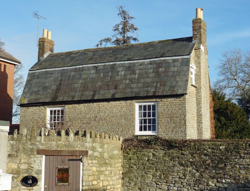
Entry Name: 6, Dammas Lane
Listing Date: 23 April 1986
Grade: II
Source: Historic England
Source ID: 1355901
English Heritage Legacy ID: 318725
ID on this website: 101355901
Location: Walcot West, Swindon, Wiltshire, SN1
County: Swindon
Electoral Ward/Division: Old Town
Parish: South Swindon
Built-Up Area: Swindon
Traditional County: Wiltshire
Lieutenancy Area (Ceremonial County): Wiltshire
Church of England Parish: Swindon Christ Church
Church of England Diocese: Bristol
Tagged with: Building
DAMMAS LANE SU 1583 NE SWINDON (north side) 8/66 No. 6 II
House, C18. Coursed rubble, mansard stone slate roof. 2-storey, 3 bays with rear wing. Gable stacks. Central entrance and flanking reception rooms. 9-pane glazed door with lower fielded panel. 16- pane sashes with stone lintels.
Listing NGR: SU1593683723
External links are from the relevant listing authority and, where applicable, Wikidata. Wikidata IDs may be related buildings as well as this specific building. If you want to add or update a link, you will need to do so by editing the Wikidata entry.


Other nearby listed buildings