Latitude: 51.5515 / 51°33'5"N
Longitude: -1.7698 / 1°46'11"W
OS Eastings: 416059
OS Northings: 183651
OS Grid: SU160836
Mapcode National: GBR YSZ.KQ
Mapcode Global: VHB3M.88RF
Plus Code: 9C3WH62J+J3
Entry Name: Church of the Holy Rood
Listing Date: 2 October 1951
Grade: II
Source: Historic England
Source ID: 1023505
English Heritage Legacy ID: 318777
ID on this website: 101023505
Location: The Lawn, Old Town, Swindon, Wiltshire, SN3
County: Swindon
Electoral Ward/Division: Old Town
Parish: South Swindon
Built-Up Area: Swindon
Traditional County: Wiltshire
Lieutenancy Area (Ceremonial County): Wiltshire
Church of England Parish: Swindon Christ Church
Church of England Diocese: Bristol
SWINDON THE LAWN SU 18 SE 4/116 Church of the Holy Rood 2.10.51 II
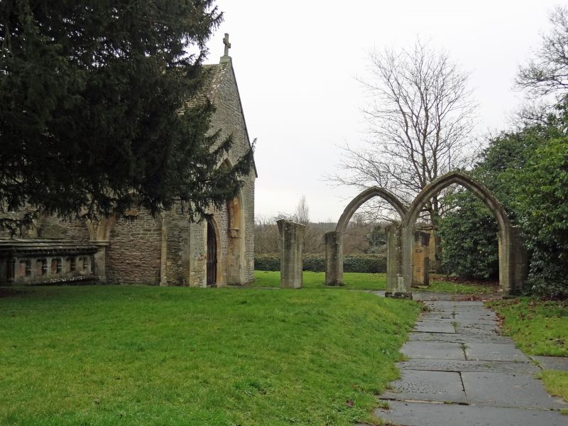
Chapel, formerly Anglican parish church. C13 and 1736. Rubble limestone, ashlar piers and dressings. Stone slate roof. Chancel blocked at west end and former north porch reset as west door. Three bays of ruined nave arcade, reset at lower level. The north wall of the chapel has 3 blocked arches of former arcade of 2 chamfered orders on a circular column with nailhead ornament on the capital. Chancel arch also of 2 orders on bold C13-C14 corbels of a king and queen. The nave piers are hexagonal with keel on intrados carried round the arches without intervening capitals. Blocked north chancel door. South and east windows of C18, round headed, and a blocked south door with bracketed cornice and inscription recording the restoration by John Vilett, knight and lay rector, in 1736. Numerous C18-early C19 tombstone form paving in former nave. The nave, north and south aisles and the west tower were demolished in 1852. Interior: open timber roof of 4 bays, the trusses re- modlled in C18. Walls plastered and colourwashed. There is a fine collection of memorials refixed to the walls in the C19, and some unfixed slabs. Significant are those of Elenor Huchens, coloured and gilded chalk, 1610; Rev. John Neate, died 1719, with broken pediment and flanking pilasters; Mrs Millicent Neate, died 1764, marble urns on pyramid over a sarcophagus; Mary Wayt, died 1724, aedicule with broken pediment, putto below; William Horne, died 1730, Latin inscription within aedicule with broken pediment. There are also a C19 font and pulpit. The grave- slabs laid in the former nave, now externally, are also of interest, including John Alexander, died 1697 aged 117 years. (Bird D. The Story of Holy Rood, 1975.)
Listing NGR: SU1605983651


Other nearby listed buildings