Approximate Location Map
Large Map »
Latitude: 51.5517 / 51°33'6"N
Longitude: -1.6511 / 1°39'3"W
OS Eastings: 424289
OS Northings: 183707
OS Grid: SU242837
Mapcode National: GBR 5WY.PDJ
Mapcode Global: VHC14.B8H8
Plus Code: 9C3WH82X+MH
Entry Name: Boundary Walls to Prebendal Farm
Listing Date: 20 September 1979
Grade: II
Source: Historic England
Source ID: 1355995
English Heritage Legacy ID: 318204
ID on this website: 101355995
Location: Bishopstone, Swindon, Wiltshire, SN6
County: Swindon
Civil Parish: Bishopstone
Built-Up Area: Bishopstone
Traditional County: Wiltshire
Lieutenancy Area (Ceremonial County): Wiltshire
Church of England Parish: Bishopstone with Hinton Parva
Church of England Diocese: Bristol
Tagged with: Wall
1.
5410
SU 2483
28/39
BISHOPSTONE
HINTON ROAD
Boundary walls to Prebendal Farm
II
2.
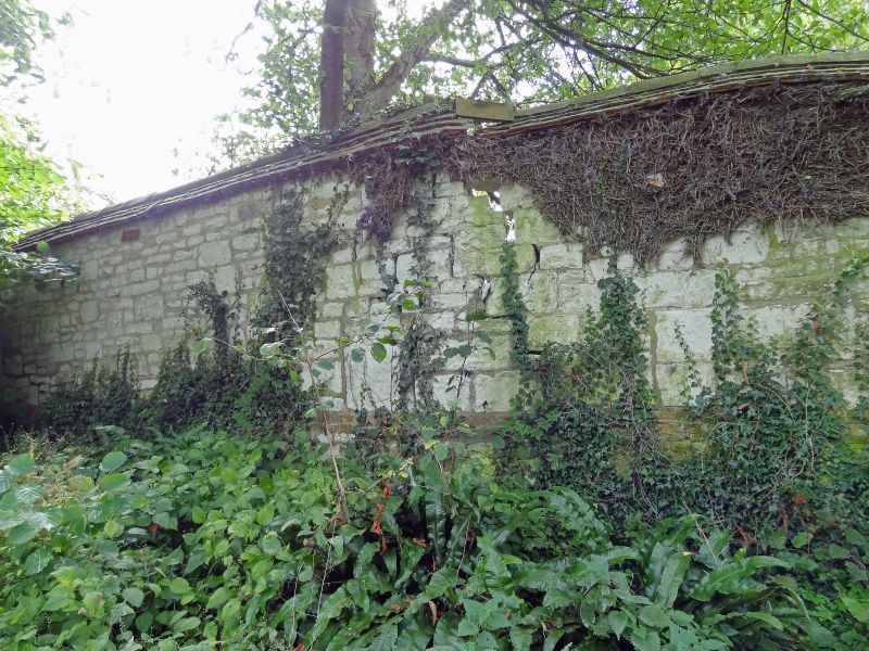
Mid C19 coursed and dressed chalk rubble, part with brick lacing courses. Tiled
capping. About 5 or 6 ft high enclosing most of farm and a paddock.
Included as contribution to the character of the village.
Listing NGR: SU2428983707
External links are from the relevant listing authority and, where applicable, Wikidata. Wikidata IDs may be related buildings as well as this specific building. If you want to add or update a link, you will need to do so by editing the Wikidata entry.


Other nearby listed buildings
