Approximate Location Map
Large Map »
Latitude: 51.643 / 51°38'34"N
Longitude: -1.8548 / 1°51'17"W
OS Eastings: 410141
OS Northings: 193808
OS Grid: SU101938
Mapcode National: GBR 3RV.ZVR
Mapcode Global: VHB2Z.SYSW
Plus Code: 9C3WJ4VW+53
Entry Name: 81, High Street
Listing Date: 28 August 1976
Grade: II
Source: Historic England
Source ID: 1356068
English Heritage Legacy ID: 317818
ID on this website: 101356068
Location: Cricklade, Wiltshire, SN6
County: Wiltshire
Civil Parish: Cricklade
Built-Up Area: Cricklade
Traditional County: Wiltshire
Lieutenancy Area (Ceremonial County): Wiltshire
Church of England Parish: Cricklade
Church of England Diocese: Bristol
Tagged with: Building
SU 19 SW CRICKLADE HIGH STREET
(east side)
13/168 No. 81
28.8.76
GV II
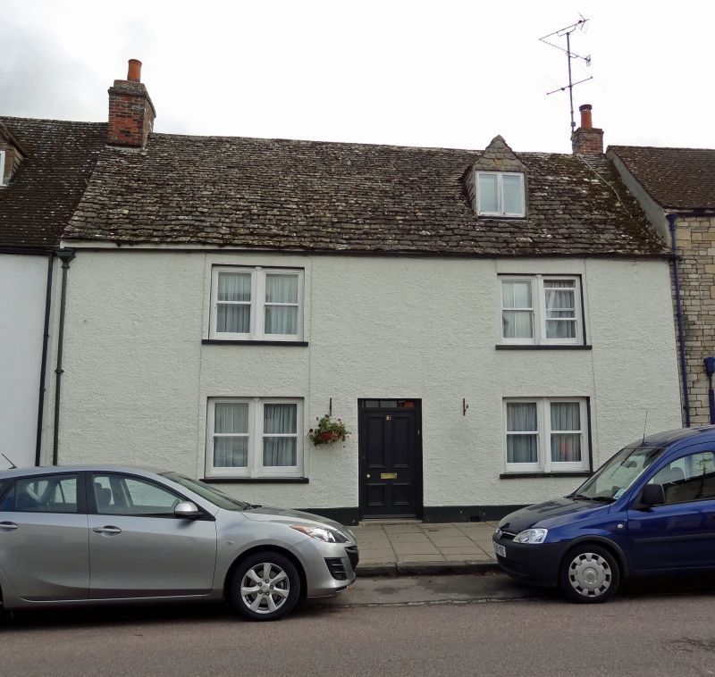
House. C17 or early C18, altered. Pebbledash rendering on front
with stone slate roof. Three bays. Off-centre door of 4 moulded
panels and narrow 3-pane fanlight. Paired plate glass sashes.
Single gabled dormer with 2-light window. Left gable stack.
Central corridor internally with large stack to left room.
Listing NGR: SU1014393810
External links are from the relevant listing authority and, where applicable, Wikidata. Wikidata IDs may be related buildings as well as this specific building. If you want to add or update a link, you will need to do so by editing the Wikidata entry.


Other nearby listed buildings
