Latitude: 51.2135 / 51°12'48"N
Longitude: 0.5955 / 0°35'43"E
OS Eastings: 581379
OS Northings: 149235
OS Grid: TQ813492
Mapcode National: GBR QT7.TMS
Mapcode Global: VHJMN.8RPL
Plus Code: 9F326H7W+C6
Entry Name: The White House
Listing Date: 26 April 1968
Grade: II
Source: Historic England
Source ID: 1356590
English Heritage Legacy ID: 174128
ID on this website: 101356590
Location: Sutton Valence, Maidstone, Kent, ME17
County: Kent
District: Maidstone
Civil Parish: Sutton Valence
Built-Up Area: Sutton Valence
Traditional County: Kent
Lieutenancy Area (Ceremonial County): Kent
Tagged with: House
SUTTON VALENCE BROAD STREET TQ 8049-8149 (north side) The White 7/110 House 26.4.68 6.8.68 GV II
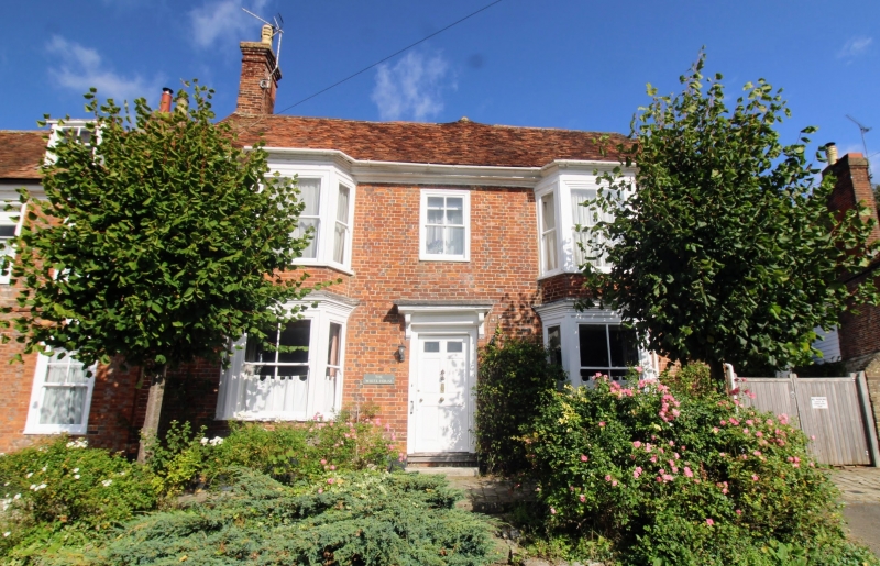
House. Later C18, possibly with earlier core, with mid C19 alterations. Red and grey brick with plain tile roof. 2 storeys garret and basement on brick plinth with rendered base. Giant brick pilaster towards each end, with moulded wooden eaves cornice carried round them. Roof half-hipped to right. Brick stack to left end and rear stack to right side of rear wing. Two 2-storey mid C19 canted bays with cornices over ground and first floor windows. Central 4-pane glazing-bar sash in open box. Central door of 4 fielded panels and 2 top lights, with corniced bracketted hood, up 2 steps. Central rear wing. Interior not inspected.
Listing NGR: TQ8136749233
External links are from the relevant listing authority and, where applicable, Wikidata. Wikidata IDs may be related buildings as well as this specific building. If you want to add or update a link, you will need to do so by editing the Wikidata entry.


Other nearby listed buildings