Latitude: 51.5077 / 51°30'27"N
Longitude: -0.125 / 0°7'29"W
OS Eastings: 530222
OS Northings: 180416
OS Grid: TQ302804
Mapcode National: GBR JF.3Q
Mapcode Global: VHGQZ.SC8K
Plus Code: 9C3XGV5G+32
Entry Name: 37, Craven Street WC2
Listing Date: 9 January 1970
Grade: II
Source: Historic England
Source ID: 1356965
English Heritage Legacy ID: 209386
ID on this website: 101356965
Location: London, Westminster, London, WC2N
County: London
District: City of Westminster
Electoral Ward/Division: St James's
Parish: Non Civil Parish
Built-Up Area: City of Westminster
Traditional County: Middlesex
Lieutenancy Area (Ceremonial County): Greater London
Church of England Parish: St Martin-in-the-Fields
Church of England Diocese: London
Tagged with: Building
TQ 3080 SW CITY OF WESTMINSTER CRAVEN STREET, WC2 83/20 9.1.70 No. 37
G.V. II
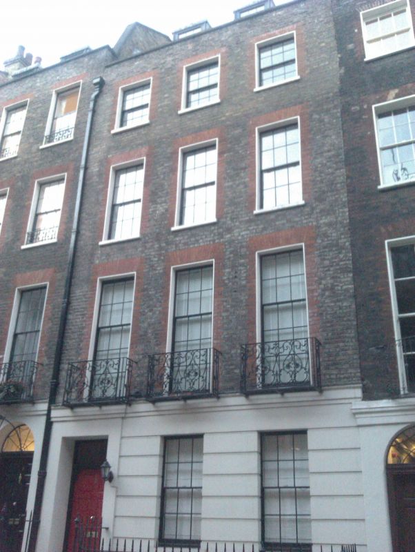
Terraced town house, c.1731 with c.1792 alterations. Brown brick with red brick window dressings, channelled stucco ground floor, slate roof. 4 storeys (top floor c.1792 heightening), C.19 dormered mansard and basement. 3 windows wide. Closet wing plan. Elliptical arched doorway to left in plain stucco surround, recessed panelled door and patterned fanlight. Recessed glazing bar sashes under flat gauged red brick arches. Cornice-band finishing off ground floor stuccowork; parapet with coping. 1st floor cast iron geometric patterned balcony. Cast iron area railings with urn finials. Interior retains most of original features with fielded panelling and cornices, pilastered archway from passage-hall to panelled stairwell with dog leg, cut and carved string staircase, changing to closed string for top flights, 3 turned balusters per tread and columnar newels; the main rooms have wood cyma cornices enriched with egg and tongue and leaf carving, etc. Part of the Craven family's C.18 development of their Brewhouse estate, laid out by Flitcroft.
Survey of London; Vol. XVIII.
Listing NGR: TQ3022280416
External links are from the relevant listing authority and, where applicable, Wikidata. Wikidata IDs may be related buildings as well as this specific building. If you want to add or update a link, you will need to do so by editing the Wikidata entry.


Other nearby listed buildings