Approximate Location Map
Large Map »
Latitude: 51.4998 / 51°29'59"N
Longitude: -0.1514 / 0°9'5"W
OS Eastings: 528408
OS Northings: 179493
OS Grid: TQ284794
Mapcode National: GBR BJ.5J
Mapcode Global: VHGQZ.BK9M
Plus Code: 9C3XFRXX+WC
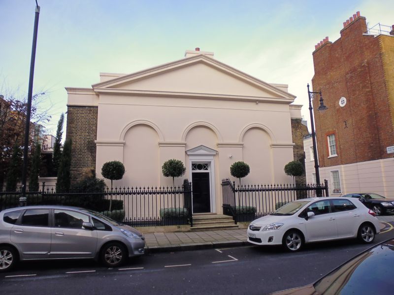
Entry Name: 28A, Chapel Street SW1
Listing Date: 9 January 1970
Grade: II
Source: Historic England
Source ID: 1357289
English Heritage Legacy ID: 209081
ID on this website: 101357289
Location: Hyde Park Corner, Westminster, London, SW1X
County: London
District: City of Westminster
Electoral Ward/Division: Knightsbridge and Belgravia
Parish: Non Civil Parish
Built-Up Area: City of Westminster
Traditional County: Middlesex
Lieutenancy Area (Ceremonial County): Greater London
Church of England Parish: St Paul Knightsbridge
Church of England Diocese: London
Tagged with: Building
TQ 2879 SW CITY OF WESTMINSTER CHAPEL STREET, SW1
TQ 2879 NW
97/25 88/51
9.1.70 No 28a
GV II
House circa 1875. Stucco. Roof not visible. Single tall storey. Pedimented
3-bay front with 3 tall blind arches. Central pedimented entrance. Narrow
paired sashes with glazing bars, to each side. Cast iron area railings.
Listing NGR: TQ2840879493
External links are from the relevant listing authority and, where applicable, Wikidata. Wikidata IDs may be related buildings as well as this specific building. If you want to add or update a link, you will need to do so by editing the Wikidata entry.


Other nearby listed buildings
