Latitude: 51.5189 / 51°31'7"N
Longitude: -0.184 / 0°11'2"W
OS Eastings: 526095
OS Northings: 181559
OS Grid: TQ260815
Mapcode National: GBR 29.WP
Mapcode Global: VHGQY.R2LY
Plus Code: 9C3XGR98+H9
Entry Name: Westbourne Bridge
Listing Date: 1 December 1987
Grade: II
Source: Historic England
Source ID: 1357363
English Heritage Legacy ID: 207571
ID on this website: 101357363
Location: Paddington, Westminster, London, W2
County: London
District: City of Westminster
Electoral Ward/Division: Hyde Park
Parish: Non Civil Parish
Built-Up Area: City of Westminster
Traditional County: Middlesex
Lieutenancy Area (Ceremonial County): Greater London
Church of England Parish: St James Paddington
Church of England Diocese: London
Tagged with: Bridge
TQ 2681 NW CITY OF WESTMINSTER WESTBOURNE TERRACE, W2
40/55
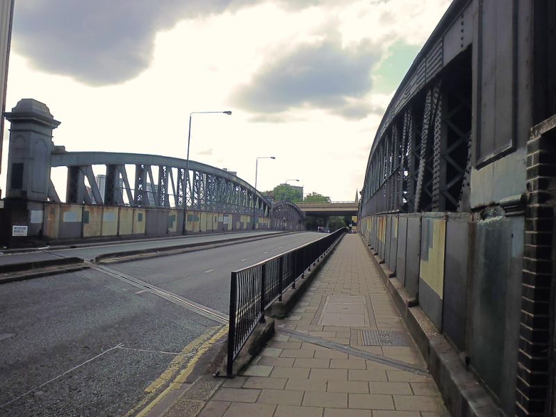
Westbourne Bridge
GV II
Road bridge. After 1909. Great Western Railway. Steel. N-girder bridge
of bow string shape of 2 long spans with central piers. Centre and ends with
finialed decorative standards.
Listing NGR: TQ2609581559
External links are from the relevant listing authority and, where applicable, Wikidata. Wikidata IDs may be related buildings as well as this specific building. If you want to add or update a link, you will need to do so by editing the Wikidata entry.


Other nearby listed buildings