Approximate Location Map
Large Map »
Latitude: 51.5851 / 51°35'6"N
Longitude: -0.0111 / 0°0'40"W
OS Eastings: 537888
OS Northings: 189234
OS Grid: TQ378892
Mapcode National: GBR KT.V59
Mapcode Global: VHGQN.RFG6
Plus Code: 9C3XHXPQ+2G
Entry Name: Wall to South East Side of Graveyard to St Mary's Church
Listing Date: 24 February 1987
Grade: II
Source: Historic England
Source ID: 1357602
English Heritage Legacy ID: 206854
ID on this website: 101357602
Location: St Mary's Church, Central Parade, Waltham Forest, London, E17
County: London
District: Waltham Forest
Electoral Ward/Division: Hoe Street
Parish: Non Civil Parish
Built-Up Area: Waltham Forest
Traditional County: Essex
Lieutenancy Area (Ceremonial County): Greater London
Church of England Parish: Walthamstow St Mary the Virgin
Church of England Diocese: Chelmsford
Tagged with: Wall
TQ 3789 CHURCH END
Walthamstow E17
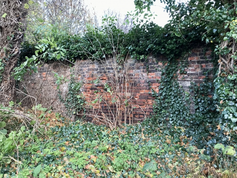
4/34 (north side)
- Wall to south east side of
graveyard to St Mary's Church
GV II
Wall. Probably C18, partly rebuilt. Red brick. About two metres high. Included
for group value.
Listing NGR: TQ3788889234
External links are from the relevant listing authority and, where applicable, Wikidata. Wikidata IDs may be related buildings as well as this specific building. If you want to add or update a link, you will need to do so by editing the Wikidata entry.


Other nearby listed buildings
