Approximate Location Map
Large Map »
Latitude: 51.4576 / 51°27'27"N
Longitude: -0.1954 / 0°11'43"W
OS Eastings: 525475
OS Northings: 174720
OS Grid: TQ254747
Mapcode National: GBR CC.WZD
Mapcode Global: VHGR4.KMKH
Plus Code: 9C3XFR53+2V
Entry Name: Church of All Saints
Listing Date: 14 July 1955
Grade: II*
Source: Historic England
Source ID: 1357684
English Heritage Legacy ID: 207173
ID on this website: 101357684
Location: Wandsworth, London, SW18
County: London
District: Wandsworth
Electoral Ward/Division: Fairfield
Parish: Non Civil Parish
Built-Up Area: Wandsworth
Traditional County: Surrey
Lieutenancy Area (Ceremonial County): Greater London
Church of England Parish: Wandsworth All Saints
Church of England Diocese: Southwark
Tagged with: Church building
WANDSWORTH HIGH STREET SW18
1.
5033
(north side)
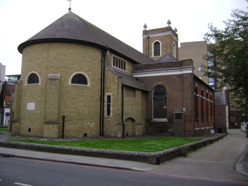
Church of All Saints
TQ 2574 12/3 14.7.55
II*
2.
Tower 1630, refaced and raised 1841.
Body of church largely rebuilt 1779: surveyor William Jupp. Alteration and
improvement 1841. Further alterations 1859. Chancel and new roof 1899 to 1900
by E W Mountford. Amber brick. Round-arched windows, with gauged yellow brick
arches. Slate roof. South porch of 2-bay projection with modified Corinthian
columns, plain frieze and mutule cornice with pediment.
Galleried interior tunnel-vaulted on marbled wood Doric columns.
Monuments. (RCHM).
Listing NGR: TQ2547574720
External links are from the relevant listing authority and, where applicable, Wikidata. Wikidata IDs may be related buildings as well as this specific building. If you want to add or update a link, you will need to do so by editing the Wikidata entry.


Other nearby listed buildings
