Approximate Location Map
Large Map »
Latitude: 51.5653 / 51°33'55"N
Longitude: 0.2178 / 0°13'4"E
OS Eastings: 553814
OS Northings: 187494
OS Grid: TQ538874
Mapcode National: GBR TF.5KV
Mapcode Global: VHHN7.QXHD
Plus Code: 9F32H689+44
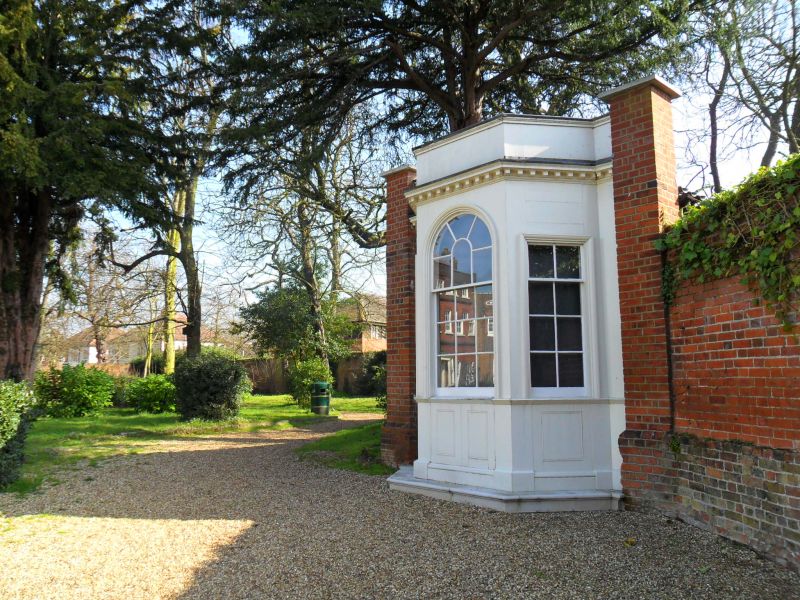
Entry Name: Gazebo at Langtons
Listing Date: 19 January 1978
Grade: II
Source: Historic England
Source ID: 1358504
English Heritage Legacy ID: 201546
ID on this website: 101358504
Location: Langtons Gardens, Hornchurch, Havering, London, RM11
County: London
District: Havering
Electoral Ward/Division: St Andrew's
Parish: Non Civil Parish
Built-Up Area: Havering
Traditional County: Essex
Lieutenancy Area (Ceremonial County): Greater London
Church of England Parish: Hornchurch St Andrew
Church of England Diocese: Chelmsford
Tagged with: Gazebo
5017
TQ 58 NW 10/9B
BILLET LANE, Hornchurch
Gazebo at Langtons
19.1.78
GV II
C18. Single storey canted wooden front with round headed entrance and flat-headed
sash windows in angled faces (bottom halves of sashes removed). Wooden band
under windows modillion cornice and parapet.
Listing NGR: TQ5381487494
External links are from the relevant listing authority and, where applicable, Wikidata. Wikidata IDs may be related buildings as well as this specific building. If you want to add or update a link, you will need to do so by editing the Wikidata entry.


Other nearby listed buildings
