Latitude: 51.5071 / 51°30'25"N
Longitude: -0.2953 / 0°17'43"W
OS Eastings: 518406
OS Northings: 180063
OS Grid: TQ184800
Mapcode National: GBR 7X.N7K
Mapcode Global: VHGQW.TDR0
Plus Code: 9C3XGP43+RV
Entry Name: Church of All Saints
Listing Date: 19 January 1981
Grade: II
Source: Historic England
Source ID: 1358763
English Heritage Legacy ID: 200928
Also known as: All Saints, Ealing
ID on this website: 101358763
Location: All Saints' Church, Ealing, London, W5
County: London
District: Ealing
Electoral Ward/Division: Ealing Common
Parish: Non Civil Parish
Built-Up Area: Ealing
Traditional County: Middlesex
Lieutenancy Area (Ceremonial County): Greater London
Church of England Parish: All Saints Ealing
Church of England Diocese: London
Tagged with: Church building
ELM GROVE ROAD
1.
5010
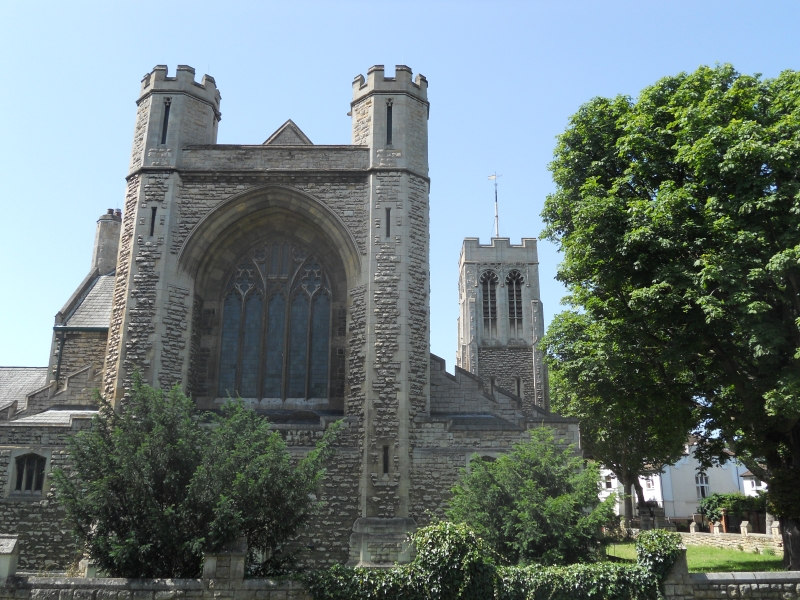
Church of Al Saints
TQ 18 SE 2/81
II
2.
1905 by William Alfred Pite. Rock faced squared and coursed rubble with north-
west tower. Nave and lean-to aisles with heavy castellated east end. Main
entrance doors under tower.
Listing NGR: TQ1840680063
External links are from the relevant listing authority and, where applicable, Wikidata. Wikidata IDs may be related buildings as well as this specific building. If you want to add or update a link, you will need to do so by editing the Wikidata entry.


Other nearby listed buildings