Latitude: 51.5811 / 51°34'51"N
Longitude: -0.1892 / 0°11'20"W
OS Eastings: 525567
OS Northings: 188467
OS Grid: TQ255884
Mapcode National: GBR C4.4YX
Mapcode Global: VHGQK.NJV9
Plus Code: 9C3XHRJ6+C8
Entry Name: The Institute (The Henrietta Barnett School)
Listing Date: 18 March 1965
Grade: II*
Source: Historic England
Source ID: 1359028
English Heritage Legacy ID: 198834
ID on this website: 101359028
Location: Golders Green, Barnet, London, NW11
County: London
District: Barnet
Electoral Ward/Division: Garden Suburb
Parish: Non Civil Parish
Built-Up Area: Barnet
Traditional County: Middlesex
Lieutenancy Area (Ceremonial County): Greater London
Church of England Parish: St Jude-on-the-Hill Hampstead Garden Suburb
Church of England Diocese: London
Tagged with: Secondary school Architectural structure Grammar school Academy school Girls' school
This list entry was subject to a Minor Amendment on 28 August 2025 to update the Name and Address and reformat the text to current standards
TQ 2588
26/94
Hampstead Garden Suburb
CENTRAL SQUARE NW11
The Institute (The Henrietta Barnett School)
(Formerly listed as The Institute)
18.3.1965
II*
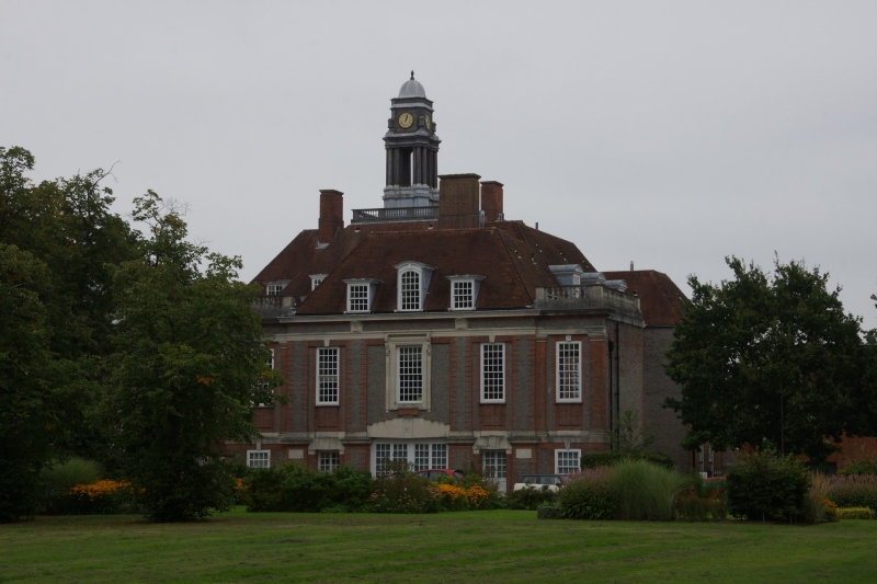
Architect Sir Edwin Lutyens and others. Elevations to Central Square. Two storeys and dormers in roof. Of grey and red bricks and stone dressings. Tile roofs. The ground storey is treated as a podium and the first storey is principal and is pilastered. The central block is recessed the full depth of the side wings and this feature is of five window bays. The central window is pedimented and stone dressed. The centre is mansard roofed, with dormers, and supports an elaborate cupola. The side wings are of five windows and of similar treatment. The courtyard elevations to these wings have niches either side of the centre feature. There are cornices with stone balustraded parapets throughout.
The rear elevation. Owing to the falling ground this elevation gives a totally different impression from the elevation to the Square. It is of three storeys constructed in silvergrey brick, with red brick window and quoin dressings, and stone bands, etc. The centre feature projects and is carried up above the eaves (or parapet) to make four storeys and is a tripartite stone treatment in the Ionic Order, of pilasters for the two upper storeys. The ground storey (of podium height and character) is rusticated and has round arched windows, with, above, a balustraded balcony. The first floor has full height sashes but is simple in treatment. The whole is surmounted by a pediment above and behind which is the previously mentioned elaborate cupola.
Listing NGR: TQ2555988446
External links are from the relevant listing authority and, where applicable, Wikidata. Wikidata IDs may be related buildings as well as this specific building. If you want to add or update a link, you will need to do so by editing the Wikidata entry.


Other nearby listed buildings