Approximate Location Map
Large Map »
Latitude: 51.3361 / 51°20'9"N
Longitude: 1.4047 / 1°24'16"E
OS Eastings: 637245
OS Northings: 165166
OS Grid: TR372651
Mapcode National: GBR X0L.1YH
Mapcode Global: VHMCW.9PF4
Plus Code: 9F338CP3+CV
Entry Name: 140, Grange Road
Listing Date: 13 September 1974
Grade: II
Source: Historic England
Source ID: 1359671
English Heritage Legacy ID: 171755
ID on this website: 101359671
Location: Nethercourt, Thanet, Kent, CT11
County: Kent
District: Thanet
Civil Parish: Ramsgate
Built-Up Area: Ramsgate
Traditional County: Kent
Lieutenancy Area (Ceremonial County): Kent
Tagged with: Building
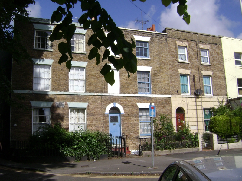
RAMSGATE GRANGE ROAD
TR 3765 SW
(west side)
7/125
13.9.74 No. 140
GV II
House. Early C19. Stock brick and slate roof. Three storeys and
basement with cill band and parapet to roof with stack to right.
Blank window space to left and glazing bar sash on 2nd and 1st floors,
and glazing bar sash on ground floor with half-glazed door to left in
keyed semi-circular headed surround. Glazing bar sash to basement.
Listing NGR: TR3724565166
External links are from the relevant listing authority and, where applicable, Wikidata. Wikidata IDs may be related buildings as well as this specific building. If you want to add or update a link, you will need to do so by editing the Wikidata entry.


Other nearby listed buildings
