Latitude: 53.4069 / 53°24'24"N
Longitude: -2.9564 / 2°57'23"W
OS Eastings: 336516
OS Northings: 390430
OS Grid: SJ365904
Mapcode National: GBR 7BN.GQ
Mapcode Global: WH877.KMDL
Plus Code: 9C5VC24V+PC
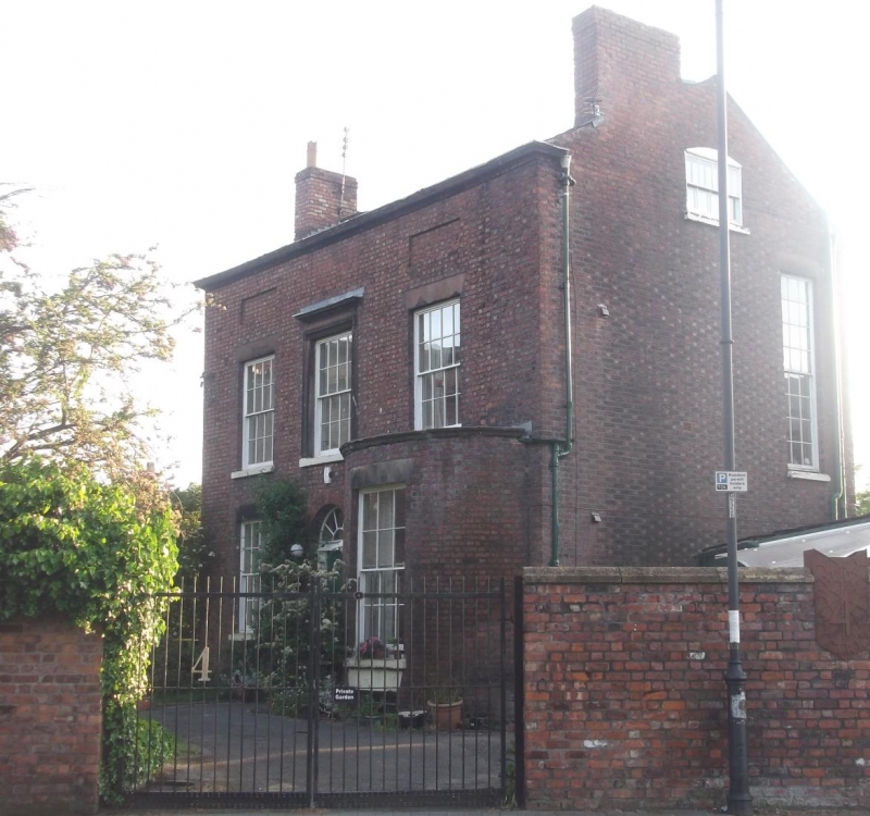
Entry Name: All Saints' Vicarage
Listing Date: 19 June 1985
Grade: II
Source: Historic England
Source ID: 1359868
English Heritage Legacy ID: 359614
ID on this website: 101359868
Location: Edge Hill, Liverpool, Merseyside, L7
County: Liverpool
Electoral Ward/Division: Picton
Parish: Non Civil Parish
Built-Up Area: Liverpool
Traditional County: Lancashire
Lieutenancy Area (Ceremonial County): Merseyside
Church of England Parish: Liverpool, All Saints
Church of England Diocese: Liverpool
Tagged with: Clergy house
This list entry was subject to a Minor Amendment on 14 April 2025 to amend the name and address and reformat the text to current standards
SJ 3690
28/1234
TOWERLANDS STREET L7
No 4, All Saints' Vicarage
(Formerly listed as Saint Mary's Vicarage, TOWERLANDS STREET)
GV.
II
Vicarage. c.1815. Brick with stone dressings, slate roof. Two storeys with basement, three bays. Top cornice. Third bay has bayed ground floor. Windows have wedge lintels and are sashed with glazing bars; windows over entrance has architrave frieze and cornice, windows flanking this have recessed panels over. Central round-headed entrance has plain doorcase and four-panel door.
Listing NGR: SJ3651690430
External links are from the relevant listing authority and, where applicable, Wikidata. Wikidata IDs may be related buildings as well as this specific building. If you want to add or update a link, you will need to do so by editing the Wikidata entry.


Other nearby listed buildings