Approximate Location Map
Large Map »
Latitude: 52.653 / 52°39'10"N
Longitude: -0.477 / 0°28'37"W
OS Eastings: 503124
OS Northings: 307225
OS Grid: TF031072
Mapcode National: GBR FVS.L84
Mapcode Global: WHGLX.NL21
Plus Code: 9C4XMG3F+56
Entry Name: 31, High Street
Listing Date: 26 April 1974
Grade: II
Source: Historic England
Source ID: 1360403
English Heritage Legacy ID: 193557
ID on this website: 101360403
Location: Stamford, South Kesteven, Lincolnshire, PE9
County: Lincolnshire
District: South Kesteven
Civil Parish: Stamford
Built-Up Area: Stamford
Traditional County: Lincolnshire
Lieutenancy Area (Ceremonial County): Lincolnshire
Church of England Parish: Stamford St Mary
Church of England Diocese: Lincoln
Tagged with: Building
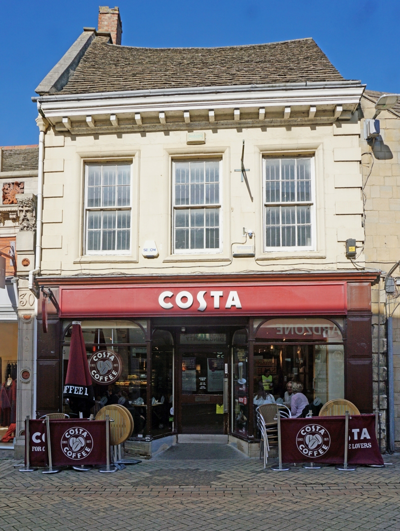
1.
1671 HIGH STREET
(North Side)
No 31
TF 0307 1/103
II GV
2.
Early C18. 2 storeys in painted stone. Stone slate roof. Heavy dentil eaves
cornice. Block rusticated quoins. 3 windows in bolection moulded stone surrounds,
double-hung sashes with glazing bars, Late C19 slop front.
Nos 14 to 31 (consec) and Public Library form a group.
Listing NGR: TF0312407225
External links are from the relevant listing authority and, where applicable, Wikidata. Wikidata IDs may be related buildings as well as this specific building. If you want to add or update a link, you will need to do so by editing the Wikidata entry.


Other nearby listed buildings
