Latitude: 51.4518 / 51°27'6"N
Longitude: -0.4402 / 0°26'24"W
OS Eastings: 508481
OS Northings: 173684
OS Grid: TQ084736
Mapcode National: GBR 30.7P9
Mapcode Global: VHFTK.BR4Y
Plus Code: 9C3XFH25+PW
Entry Name: Church of St Mary
Listing Date: 14 August 1953
Grade: II
Source: Historic England
Source ID: 1360959
English Heritage Legacy ID: 438466
Also known as: St. Mary's Church, Bedfont
Church of St Mary the Virgin, Bedfont
ID on this website: 101360959
Location: St Mary's Church, East Bedfont, Hounslow, London, TW14
County: London
District: Hounslow
Electoral Ward/Division: Bedfont
Parish: Non Civil Parish
Built-Up Area: Hounslow
Traditional County: Middlesex
Lieutenancy Area (Ceremonial County): Greater London
Church of England Parish: St Mary Bedfont
Church of England Diocese: London
Tagged with: Church building
1. 4419 STAINES ROAD, BEDFONT (East Bedfont)
Church of St Mary
TQ 0873 39/400 14.8.53.
II
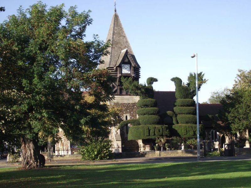
2. Norman, with original chancel, retaining chancel arch and 1 window, and part of original nave retaining good South doorway. Wall paintings of circa 1300 to North of chancel arch. Mediaeval King-post roofs to nave and chancel. Pleasant series of tablets of C18 and early C19 date, and brass to William Page and Isabell his mother 1629-32. Gravestones and table tombs of C18 and later date in churchyard and pair of yew trees, formerly clipped and originally bearing initials and the date of 1704. The church was enlarged in the early C19 on the North side and again circa 1865 when the nave was lengthened and a new tower and South porch were built. VCH; RCHM; Lysons' Middlesex Parishes. NMR.
Listing NGR: TQ0848173684
External links are from the relevant listing authority and, where applicable, Wikidata. Wikidata IDs may be related buildings as well as this specific building. If you want to add or update a link, you will need to do so by editing the Wikidata entry.


Other nearby listed buildings