Latitude: 53.7059 / 53°42'21"N
Longitude: -2.2858 / 2°17'8"W
OS Eastings: 381228
OS Northings: 423308
OS Grid: SD812233
Mapcode National: GBR DTGL.X9
Mapcode Global: WH97B.V3PV
Plus Code: 9C5VPP47+8M
Entry Name: Gateway to Rawtenstall Cemetery
Listing Date: 30 November 1984
Grade: II
Source: Historic England
Source ID: 1361994
English Heritage Legacy ID: 185738
ID on this website: 101361994
Location: Rawtenstall Cemetery, Constable Lee, Rossendale, Lancashire, BB4
County: Lancashire
District: Rossendale
Electoral Ward/Division: Cribden
Parish: Non Civil Parish
Built-Up Area: Rawtenstall
Traditional County: Lancashire
Lieutenancy Area (Ceremonial County): Lancashire
Church of England Parish: Constable Lee St Paul
Church of England Diocese: Manchester
Tagged with: Gate
SD 82 SW RAWTENSTAL L BURNLEY ROAD
14/159 Gateway to Rawtenstall Cemetery - - II
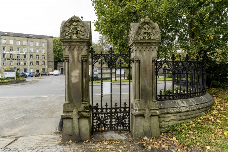
Gateway to cemetery, consisting of 4 stone piers and iron gates; later C19. Dressed sandstone and cast iron. Gothic style. All piers square in section and c.3 metres high, with slightly tapered pedestals, foliated shafts at the corners, arcaded frieze, hollow cornice with ball flower ornament and carved trefoil-faced caps displaying crosses, flowers, crowns, and those at the outer end the letters "RC". Ornamental open-work gates. (Low boundary wall lacking railings, and originally-matching piers at outer ends of these walls, now damaged, not included in the item).
Listing NGR: SD8122823308
External links are from the relevant listing authority and, where applicable, Wikidata. Wikidata IDs may be related buildings as well as this specific building. If you want to add or update a link, you will need to do so by editing the Wikidata entry.


Other nearby listed buildings