Latitude: 53.9262 / 53°55'34"N
Longitude: -2.5223 / 2°31'20"W
OS Eastings: 365801
OS Northings: 447916
OS Grid: SD658479
Mapcode National: GBR BRT1.Q9
Mapcode Global: WH962.7K5X
Plus Code: 9C5VWFGH+F3
Entry Name: Burholme Bridge
Listing Date: 16 November 1954
Grade: II
Source: Historic England
Source ID: 1362265
English Heritage Legacy ID: 183075
ID on this website: 101362265
Location: Ribble Valley, Lancashire, BB7
County: Lancashire
District: Ribble Valley
Civil Parish: Bowland Forest Low
Traditional County: Yorkshire
Lieutenancy Area (Ceremonial County): Lancashire
Tagged with: Bridge
SD 64 NE BOWLAND FOREST LOW
14/24 Burholme Bridge 16.11.1954 - II
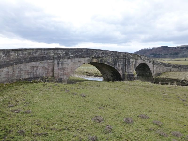
Bridge over the River Hodder, late C18th. Sandstone ashlar. 2 elliptical arches with triangular cutwaters and a solid parapet with string course and weathered coping.
Listing NGR: SD6580147916
External links are from the relevant listing authority and, where applicable, Wikidata. Wikidata IDs may be related buildings as well as this specific building. If you want to add or update a link, you will need to do so by editing the Wikidata entry.


Other nearby listed buildings