Latitude: 54.1029 / 54°6'10"N
Longitude: -2.79 / 2°47'23"W
OS Eastings: 348440
OS Northings: 467730
OS Grid: SD484677
Mapcode National: GBR 8NYZ.SZ
Mapcode Global: WH841.34PH
Plus Code: 9C6V4636+42
Entry Name: Hawkshead Farmhouse
Listing Date: 1 August 1952
Grade: II*
Source: Historic England
Source ID: 1362399
English Heritage Legacy ID: 181786
ID on this website: 101362399
Location: Bolton-le-Sands, Lancaster, Lancashire, LA5
County: Lancashire
District: Lancaster
Civil Parish: Bolton-le-Sands
Built-Up Area: Bolton-le-Sands
Traditional County: Lancashire
Lieutenancy Area (Ceremonial County): Lancashire
Church of England Parish: Bolton-le-Sands Holy Trinity
Church of England Diocese: Blackburn
Tagged with: Farmhouse
SD 48 67 BOLTON-LE-SANDS THE NOOK
13/22 No. 1 (Hawkshead Farmhouse) 1. 8. 1952
GV II*
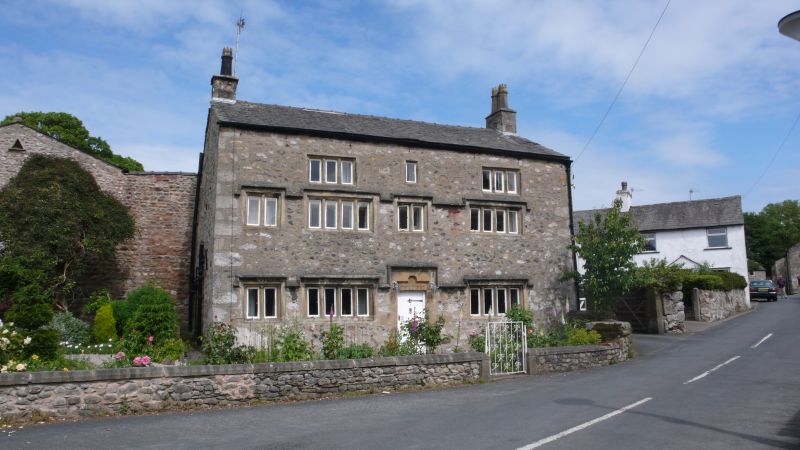
House, 'RC TBC 1665' on lintel. Sandstone and limestone rubble with sandstone dressings and slate roof. 2-unit central-entry plan with gable stacks. 2½ storeys. Rebated and chamfered mullioned windows with continuous drip course on the ground and 1st floors rising over each window. At the left end of the facade is a 2-light fire window. To the left of the door is a 4-light window, with one of 4 lights to the right of the door. 1st floor similar but with a 2-light window over the door. Attic has a 3-light window on each side of a central plain chamfered surround. Chamfer of door jambs continues around lintel. Left-hand return wall has one-light chamfered window openings on 1st and attic floors. Right-hand wall has a 2-light rebated and chamfered mullioned window on the ground floor with 2 one-light plain chamfered windows on the 1st floor and one to the attic. Later outshut at rear.
Listing NGR: SD4844067730
External links are from the relevant listing authority and, where applicable, Wikidata. Wikidata IDs may be related buildings as well as this specific building. If you want to add or update a link, you will need to do so by editing the Wikidata entry.


Other nearby listed buildings