Latitude: 51.0953 / 51°5'42"N
Longitude: 0.9491 / 0°56'56"E
OS Eastings: 606593
OS Northings: 137020
OS Grid: TR065370
Mapcode National: GBR SYX.6RF
Mapcode Global: FRA D6W7.7KS
Plus Code: 9F323WWX+4J
Entry Name: Stable/Outhouse About 10 Metres North of Goldwell
Listing Date: 10 August 1988
Grade: II
Source: Historic England
Source ID: 1362780
English Heritage Legacy ID: 181625
ID on this website: 101362780
Location: Stonestreet Green, Ashford, Kent, TN25
County: Kent
District: Ashford
Civil Parish: Aldington
Traditional County: Kent
Lieutenancy Area (Ceremonial County): Kent
Tagged with: Stable
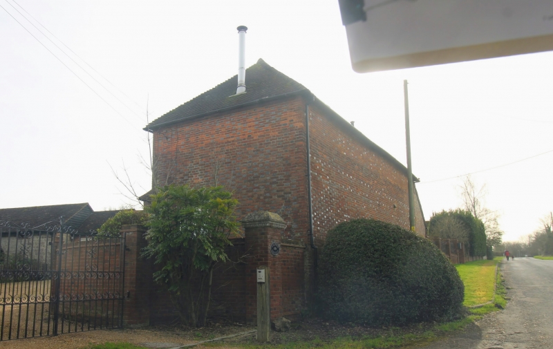
TR 03 NE ALDINGTON GOLDWELL LANE (east side) 4/40 Stable/ outhouse about 10 metres north of Goldwell GV II Stable/outhouse. C17 origin, rebuilt C18. Red and blue brick on high ragstone base with plain tiled roof, with timber framed wing with red brick infill. Main block 2 storeys on plinth with hipped roof, with 1 wooden casement on each floor and one to top right infilled. Two boarded doors on ground floor. Single storey extension with 2 wooden casements.
Listing NGR: TR0657336968
External links are from the relevant listing authority and, where applicable, Wikidata. Wikidata IDs may be related buildings as well as this specific building. If you want to add or update a link, you will need to do so by editing the Wikidata entry.


Other nearby listed buildings