Latitude: 51.13 / 51°7'47"N
Longitude: 0.7667 / 0°46'0"E
OS Eastings: 593680
OS Northings: 140381
OS Grid: TQ936403
Mapcode National: GBR RWY.2N7
Mapcode Global: VHKKL.7VPN
Plus Code: 9F324QH8+XM
Entry Name: Water Farmhouse
Listing Date: 10 October 1980
Grade: II
Source: Historic England
Source ID: 1362973
English Heritage Legacy ID: 180605
ID on this website: 101362973
Location: Bateman Corner, Ashford, Kent, TN26
County: Kent
District: Ashford
Civil Parish: Bethersden
Traditional County: Kent
Lieutenancy Area (Ceremonial County): Kent
Tagged with: Farmhouse
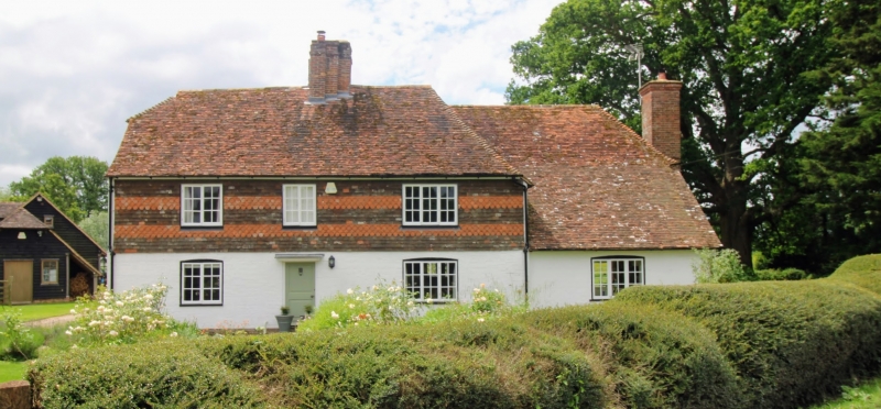
1.
5272 BETHERSDEN BATEMANS CORNER
Water Farmhouse
TQ 94 SW 14/78
II
2.
C17 or earlier timber-framed building. Ground floor now rendered, 1st floor
refaced in curved tiles. Tiled roof, half-hipped at one end. C17 chimney
stack. Three casements.
Listing NGR: TQ9368040381
External links are from the relevant listing authority and, where applicable, Wikidata. Wikidata IDs may be related buildings as well as this specific building. If you want to add or update a link, you will need to do so by editing the Wikidata entry.


Other nearby listed buildings