Latitude: 51.1302 / 51°7'48"N
Longitude: 0.7699 / 0°46'11"E
OS Eastings: 593902
OS Northings: 140415
OS Grid: TQ939404
Mapcode National: GBR RWY.3GP
Mapcode Global: VHKKL.9VCH
Plus Code: 9F324QJ9+3X
Entry Name: Robscot
Listing Date: 14 February 1967
Grade: II
Source: Historic England
Source ID: 1362998
English Heritage Legacy ID: 180624
ID on this website: 101362998
Location: Bateman Corner, Ashford, Kent, TN26
County: Kent
District: Ashford
Civil Parish: Bethersden
Traditional County: Kent
Lieutenancy Area (Ceremonial County): Kent
Tagged with: Building
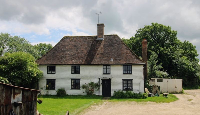
1.
5272 BETHERSDEN OLD SURRENDEN
MANOR ROAD
Robscot
TQ 94 SW 14/25 14.2.67
II
2.
Probably a late mediaeval hall-house refaced with weatherboarding, the north
wall red brick. Steeply-pitched hipped tiled roof with pentice to east. Two
storeys. Four casement windows. Doorcase with flat hood on brackets.
Listing NGR: TQ9389740438
External links are from the relevant listing authority and, where applicable, Wikidata. Wikidata IDs may be related buildings as well as this specific building. If you want to add or update a link, you will need to do so by editing the Wikidata entry.


Other nearby listed buildings