Latitude: 53.407 / 53°24'25"N
Longitude: -2.9547 / 2°57'16"W
OS Eastings: 336628
OS Northings: 390441
OS Grid: SJ366904
Mapcode National: GBR 7BN.TP
Mapcode Global: WH877.LM6H
Plus Code: 9C5VC24W+Q4
Entry Name: Clare Terrace
Listing Date: 14 March 1975
Grade: II
Source: Historic England
Source ID: 1363069
English Heritage Legacy ID: 359072
ID on this website: 101363069
Location: Edge Hill, Liverpool, Merseyside, L7
County: Liverpool
Electoral Ward/Division: Picton
Parish: Non Civil Parish
Built-Up Area: Liverpool
Traditional County: Lancashire
Lieutenancy Area (Ceremonial County): Merseyside
Church of England Parish: Liverpool, All Saints
Church of England Diocese: Liverpool
Tagged with: Building
SJ 3690 MARMADUKE STREET L7
28/735 Nos. 2 to 16 4.3.75. (even) Clare Terrace
G.V. II
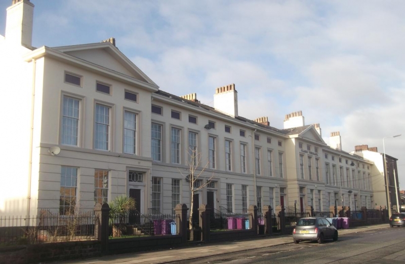
Terrace of 8 houses. Early C.19. Stucco with slate roof. 2 storeys with attic, 3 bays to each house. Ground floor has channelled rustication; 1st floor sill band; top cornice. Nos. 8 and 16 project under pediments containing windows. 1st floor windows are architraved, recessed panels over. Later flat topped dormers. Most windows to ground floor sashed with glazing bars, most 1st floor windows have casements. Entrances have eared architraves with doorcases with flat pilaster and complete fanlights. No. 2 has boarded ground floor (1984). No. 6 has no pilasters to door case. No. 8 has boarded ground floor and raised lettering over 1st floor reading 'CLARE TERRACE'; 1st floor windows are sashed with glazing bars. 1st floor windows are sashed with glazing bars. No. 16 has sashed 1st floor windows with glazing bars.
Listing NGR: SJ3662890441
External links are from the relevant listing authority and, where applicable, Wikidata. Wikidata IDs may be related buildings as well as this specific building. If you want to add or update a link, you will need to do so by editing the Wikidata entry.


Other nearby listed buildings