Approximate Location Map
Large Map »
Latitude: 51.0678 / 51°4'4"N
Longitude: 0.6879 / 0°41'16"E
OS Eastings: 588420
OS Northings: 133272
OS Grid: TQ884332
Mapcode National: GBR QW3.SX7
Mapcode Global: FRA D6B9.7V9
Plus Code: 9F323M9Q+45
Entry Name: 5-9, Bell's Lane
Listing Date: 8 June 1972
Grade: II
Source: Historic England
Source ID: 1363207
English Heritage Legacy ID: 179689
ID on this website: 101363207
Location: Tenterden, Ashford, Kent, TN30
County: Kent
District: Ashford
Civil Parish: Tenterden
Built-Up Area: Tenterden
Traditional County: Kent
Lieutenancy Area (Ceremonial County): Kent
Tagged with: Building
1.
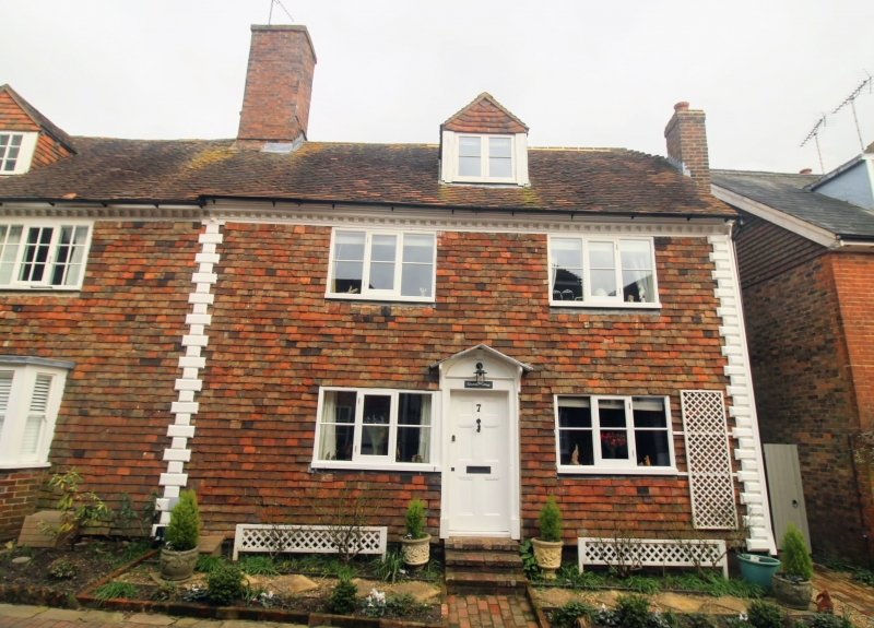
1715 BELL'S LANE
(North East Side)
Nos 5 to 9 (odd)
TQ 8833 1/123 GV
II
2.
C18 cottages. 2 storeys red brick. Bracket eaves cornice and long and
short wooden quoins. 2 casement windows each. Doorcases have moulded
wooden architraves and open pediments.
Nos 1 to 9 (odd) form a group.
Listing NGR: TQ8842033272
External links are from the relevant listing authority and, where applicable, Wikidata. Wikidata IDs may be related buildings as well as this specific building. If you want to add or update a link, you will need to do so by editing the Wikidata entry.


Other nearby listed buildings
