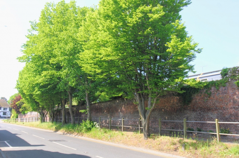
Latitude: 51.2727 / 51°16'21"N
Longitude: 1.2149 / 1°12'53"E
OS Eastings: 624338
OS Northings: 157525
OS Grid: TR243575
Mapcode National: GBR VZS.1ZF
Mapcode Global: VHLGQ.08MP
Plus Code: 9F3376F7+3W
Entry Name: Wall of Former Market Garden
Listing Date: 11 October 1963
Grade: II
Source: Historic England
Source ID: 1363321
English Heritage Legacy ID: 178352
ID on this website: 101363321
Location: Wingham, Dover, Kent, CT3
County: Kent
District: Dover
Civil Parish: Wingham
Built-Up Area: Wingham
Traditional County: Kent
Lieutenancy Area (Ceremonial County): Kent
Tagged with: Wall
TR 2457 WINGHAM HIGH STREET
(west side) 9/320 Wall of former 11.10.63 Market Garden
GV II
Wall. C16 and late C18. Red brick in English bond at base and at southern end, Flemish bond with some blue headers at northern end and in upper courses. Varying in height from about 6 to 9 feet on plinth, extending about 150 yards along west side of the High Street.
Listing NGR: TR2433957523
External links are from the relevant listing authority and, where applicable, Wikidata. Wikidata IDs may be related buildings as well as this specific building. If you want to add or update a link, you will need to do so by editing the Wikidata entry.


Other nearby listed buildings