Latitude: 51.2724 / 51°16'20"N
Longitude: 1.215 / 1°12'53"E
OS Eastings: 624348
OS Northings: 157490
OS Grid: TR243574
Mapcode National: GBR VZS.20Y
Mapcode Global: VHLGQ.08NY
Plus Code: 9F3376C7+WX
Entry Name: 41, High Street
Listing Date: 13 October 1952
Grade: II*
Source: Historic England
Source ID: 1070118
English Heritage Legacy ID: 178322
ID on this website: 101070118
Location: Wingham, Dover, Kent, CT3
County: Kent
District: Dover
Civil Parish: Wingham
Built-Up Area: Wingham
Traditional County: Kent
Lieutenancy Area (Ceremonial County): Kent
Tagged with: Building
TR 2457 WINGHAM HIGH STREET
(east side) 9/290 No. 41 13.10.52 GV II*
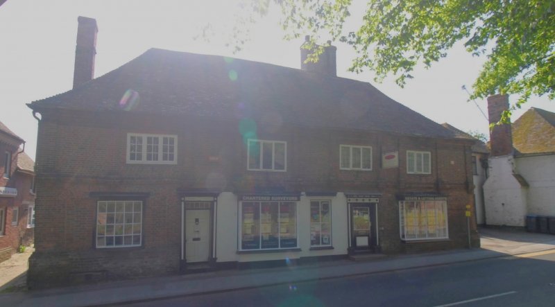
House, now offices. Late Cl7. Red brick in Flemish and English bonds with plain tiled roof. East Kent Artisan Mannerist style. Two storeys and basement with plinth with plat band and 10 brick pilasters on upper storey with moulded bases and capitals, and moulded brick eaves cornice to hipped roof with stacks to left, to rear left and clustered to right. Four 3 light wooden casements on first floor and shallow bow to left and 2 plate glass bays on ground floor with central wooden casements. Door of 6 raised and fielded panels with recrangular fanlight in moulded surround to left and half-glazed door to right with fluted pilasters and enriched cornice. Blocked segmental openings along ground floor. Faded date plaque at top right inscribed; S 1 6 ( See B.O.E. Kent II, 1983, 501) S M - 8
Listing NGR: TR2435357484
External links are from the relevant listing authority and, where applicable, Wikidata. Wikidata IDs may be related buildings as well as this specific building. If you want to add or update a link, you will need to do so by editing the Wikidata entry.


Other nearby listed buildings