Latitude: 51.3216 / 51°19'17"N
Longitude: -2.2039 / 2°12'14"W
OS Eastings: 385886
OS Northings: 158073
OS Grid: ST858580
Mapcode National: GBR 1ST.1M3
Mapcode Global: VH972.R17P
Plus Code: 9C3V8QCW+JC
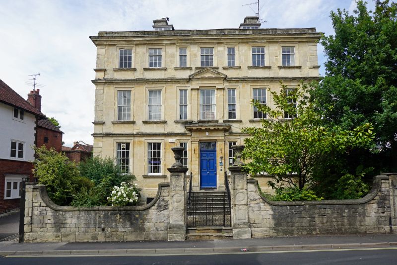
Entry Name: Front Garden Wall and Gatepiers to No 25 (Lovemead House)
Listing Date: 29 December 1950
Grade: II
Source: Historic England
Source ID: 1364176
English Heritage Legacy ID: 314120
ID on this website: 101364176
Location: Trowbridge, Wiltshire, BA14
County: Wiltshire
Civil Parish: Trowbridge
Built-Up Area: Trowbridge
Traditional County: Wiltshire
Lieutenancy Area (Ceremonial County): Wiltshire
Church of England Parish: Trowbridge St James
Church of England Diocese: Salisbury
Tagged with: Wall
ROUNDSTONE STREET 1. 5411 Front garden wall and gatepiers to No 25 ST 8558 5/46A 29.12.50. (Lovemead House) II GV
2. Early C18. Stone boundary walls with weathered coping swept up in curve to garden and stable entry walls at ends and to central square panelled stone gate piers with moulded capping and crowned by carved stone vases. The piers have small stone steps with inverted scroll heads.
Nos 2 to 4 (consec), No 5 (Rodney House) with stable yard and garden railings, stable buildings and walls, Nos 8 to 13 (consec) No 25 (Lovemead House), garden wall and gate piers form a group with Polebarn House and boundary wall, gatepiers and gates and, Polebarn Road, and Nos 1 to 6 (consec) Yerbury Almshouses, Yerbury Street.
Listing NGR: ST8588658073
External links are from the relevant listing authority and, where applicable, Wikidata. Wikidata IDs may be related buildings as well as this specific building. If you want to add or update a link, you will need to do so by editing the Wikidata entry.


Other nearby listed buildings