Latitude: 51.3537 / 51°21'13"N
Longitude: -1.6722 / 1°40'19"W
OS Eastings: 422922
OS Northings: 161676
OS Grid: SU229616
Mapcode National: GBR 5ZF.41H
Mapcode Global: VHC22.Y7TL
Plus Code: 9C3W983H+F4
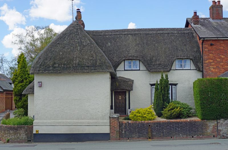
Entry Name: Burgage Stores Wayside
Listing Date: 13 June 1988
Grade: II
Source: Historic England
Source ID: 1364601
English Heritage Legacy ID: 312245
ID on this website: 101364601
Location: Westcourt, Wiltshire, SN8
County: Wiltshire
Civil Parish: Burbage
Built-Up Area: Burbage
Traditional County: Wiltshire
Lieutenancy Area (Ceremonial County): Wiltshire
Tagged with: Architectural structure Thatched cottage
BURBAGE HIGH STREET SU 26 SW (west side) 2/36 No 106 (Wayside)and Burgage Stores II
House and shop. Roughcast, probably on timber framing, thatched roof. Two storeys, 'L'-plan, with forward section on left containing shop and having flat roofed extension along south side. Entrance to house in re-entrant angle. C20 door with lean-to porch. C19 canted bay to right parlour, 2 flush paned dormers above. Forward wing has hipped roof and 2 flush dormers on south over roof of extension.
Listing NGR: SU2292261676
External links are from the relevant listing authority and, where applicable, Wikidata. Wikidata IDs may be related buildings as well as this specific building. If you want to add or update a link, you will need to do so by editing the Wikidata entry.


Other nearby listed buildings