Latitude: 51.334 / 51°20'2"N
Longitude: -1.9589 / 1°57'32"W
OS Eastings: 402959
OS Northings: 159429
OS Grid: SU029594
Mapcode National: GBR 3WL.9K2
Mapcode Global: VHB4H.0Q8R
Plus Code: 9C3W82MR+HC
Entry Name: Manor Farmhouse
Listing Date: 19 March 1962
Grade: II
Source: Historic England
Source ID: 1364705
English Heritage Legacy ID: 311627
ID on this website: 101364705
Location: Stert, Wiltshire, SN10
County: Wiltshire
Civil Parish: Stert
Traditional County: Wiltshire
Lieutenancy Area (Ceremonial County): Wiltshire
Tagged with: Farmhouse
STERT VILLAGE CENTRE SU 05 NW (north side) 9/207 Manor Farmhouse 19.3.62
GV II
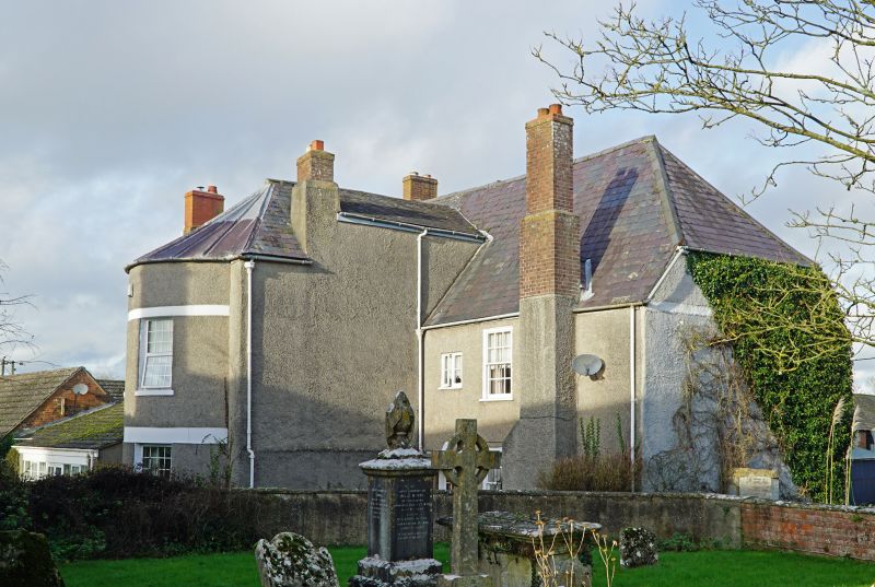
Farmhouse. C17 and late C18. Stone and timber framing with wattle and daub infilling, all roughcast, with a slate roof. Two storeys and attics. Four bays, comprising a central block with stone cross wing at west end, and second bay developed as cross wing with 2- storey bow window extension to south, and north gabled to match west wing. Entrance to projecting wing of second bay, a C17 studded timber door in moulded frame. Paned windows, tripartite to first bay dining room, and 12-pane sashes to bow at rear. False windows to gables of north front. Interior not accessible. C17 stair at end of through passage from front door, with shaped splat balusters and ball finials to newels. Timber framed wall to kitchen and chamfered ceiling beams. Building was damaged by fire in 1846 and restored.
Listing NGR: SU0295959429
External links are from the relevant listing authority and, where applicable, Wikidata. Wikidata IDs may be related buildings as well as this specific building. If you want to add or update a link, you will need to do so by editing the Wikidata entry.


Other nearby listed buildings