Latitude: 52.2504 / 52°15'1"N
Longitude: -1.6178 / 1°37'4"W
OS Eastings: 426189
OS Northings: 261421
OS Grid: SP261614
Mapcode National: GBR 5MG.ZRV
Mapcode Global: VHBXN.XP3R
Plus Code: 9C4W792J+4V
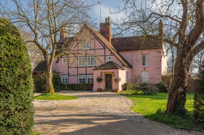
Entry Name: Church Farmhouse
Listing Date: 11 April 1967
Grade: II
Source: Historic England
Source ID: 1364972
English Heritage Legacy ID: 308120
ID on this website: 101364972
Location: Sherbourne, Warwick, Warwickshire, CV35
County: Warwickshire
District: Warwick
Civil Parish: Sherbourne
Traditional County: Warwickshire
Lieutenancy Area (Ceremonial County): Warwickshire
Church of England Parish: Sherbourne All Saints
Church of England Diocese: Coventry
Tagged with: Farmhouse
SHERBOURNE Church Lane 15/247 Church Farmhouse 11.4.67
GV II
Circa late Cl6 plastered timber frame house with extensive C18/19 stuccoed brick additions. The original three-storey timber-framed part has steeply pitched plain tile roof with gabled ends and modern casement windows. C18/19 additions to west and south-west, stuccoed, with parapet and hipped roof, two storeys, sash windows with glazing bars and porch in the angle with Tuscan columns and entablature. Short timber-framed gable to rear (north). Interior: some timber framing inside exposed and some chamfered ceiling beams. Reused carved timber overmantle arcaded and with caryatids. Formerly the vicarage.
Listing NGR: SP2618961421
External links are from the relevant listing authority and, where applicable, Wikidata. Wikidata IDs may be related buildings as well as this specific building. If you want to add or update a link, you will need to do so by editing the Wikidata entry.


Other nearby listed buildings