Latitude: 52.2508 / 52°15'3"N
Longitude: -1.6183 / 1°37'5"W
OS Eastings: 426153
OS Northings: 261475
OS Grid: SP261614
Mapcode National: GBR 5MG.ZLJ
Mapcode Global: VHBXN.WPTC
Plus Code: 9C4W792J+8M
Entry Name: 11, Church Lane
Listing Date: 11 April 1967
Grade: II
Source: Historic England
Source ID: 1364973
English Heritage Legacy ID: 308122
ID on this website: 101364973
Location: Sherbourne, Warwick, Warwickshire, CV35
County: Warwickshire
District: Warwick
Civil Parish: Sherbourne
Traditional County: Warwickshire
Lieutenancy Area (Ceremonial County): Warwickshire
Church of England Parish: Sherbourne All Saints
Church of England Diocese: Coventry
Tagged with: Building
SHERBOURNE Church Lane 15/250 No 11 11.4.67
GV II
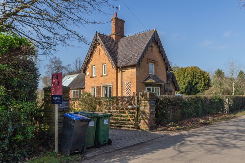
Mid C19 estate cottage. Red brick with stone dressings. Steeply pitched shaped tile roofs with ornate pierced barge boards with finials and pendants. Two storeys. Casements with small panes in chamfered stone frames with dripmoulds. Ground floor canted bay window with wide coved eaves. Gabled porch in angle to right with barge boards and four-centred arch doorway. Central brick chimney stack.
Listing NGR: SP2615361475
External links are from the relevant listing authority and, where applicable, Wikidata. Wikidata IDs may be related buildings as well as this specific building. If you want to add or update a link, you will need to do so by editing the Wikidata entry.


Other nearby listed buildings