Latitude: 51.42 / 51°25'12"N
Longitude: -1.7173 / 1°43'2"W
OS Eastings: 419751
OS Northings: 169038
OS Grid: SU197690
Mapcode National: GBR 4X2.YDD
Mapcode Global: VHC1P.5KZS
Plus Code: 9C3WC7CM+23
Entry Name: 52 and 53, London Road
Listing Date: 21 October 1974
Grade: II
Source: Historic England
Source ID: 1365411
English Heritage Legacy ID: 310435
ID on this website: 101365411
Location: Marlborough, Wiltshire, SN8
County: Wiltshire
Civil Parish: Marlborough
Built-Up Area: Marlborough
Traditional County: Wiltshire
Lieutenancy Area (Ceremonial County): Wiltshire
Tagged with: Building
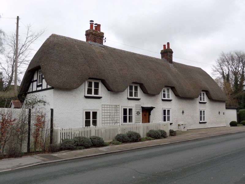
LONDON ROAD
1.
5407 (North Side)
Nos 52 and 53
SU 1969 3/235
II
2.
C18. Pebbledashed. Thatched roof. Brick stacks. 1 1/2 storeys. 4 ranges of
easements with glazing bars. 1 half-glazed door with flat hood on cut brackets.
Listing NGR: SU1975169038
External links are from the relevant listing authority and, where applicable, Wikidata. Wikidata IDs may be related buildings as well as this specific building. If you want to add or update a link, you will need to do so by editing the Wikidata entry.


Other nearby listed buildings